Volume 21, Issue 3, March 2025 |
|
|||||||||||||||||||||||||||||||
|
|||||||||||||||||||||||||||||||
Volume 21, Issue 2, February 2025 |
|
|||||||||||||||||||||
NUVIEW announced that it is building the world’s first commercial LiDAR satellite constellation which will map the entire land surface of the Earth in 3D for the first time ever.
As a first-mover company, NUVIEW is pioneering satellite, sensor, and software technology to produce high-quality, accurate data with endless application potential across industries including environmental science, …
The Government of India has taken several steps for conservation of biodiversity which includes survey, inventorization, taxonomic validation and threat assessment of floral and faunal resources; assessment to develop an accurate data base for planning and monitoring as well as conservation and protection of forests; establishment of a protected area network of National Parks, Wildlife …

A theoretical based method was employed in this research to obtain simulation results from lidar scan patterns which indicate a lot of prospects of lidar laser scanners
Very Rev Fr Mike Iroh, CM
St Simon & Jude Minor Seminary Kuje, Abuja, Nigeria
Abstract
Preview measurements of the inflow by turbine-mounted lidar systems can be used to optimize wind turbine …
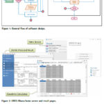
“GNSS Ghana” Software (GGS), a GNSS standalone Windows-based application with a modern user-friendly interface was developed for geodetic applications
Gameti Charles
Department of Geomatic Engineering, Kwame Nkrumah University of Science and Technology (KNUST), Kumasi, Ghana
Acheampong Akwasi Afrifa
Department of Geomatic Engineering, Kwame Nkrumah University of Science and Technology (KNUST), Kumasi, Ghana
John Ayer
Department of Geomatic Engineering, Kwame Nkrumah University …
Nexar announced that it has achieved a dramatic 40x reduction in the cost of real-time mapping by leveraging cutting-edge technologies, edge AI, change detection, and crowdsourcing.
As a result, Nexar’s CityStream Live platform is making real-time mapping data more accessible to the mobility industry than ever before.
Real-time mapping has become increasingly crucial, particularly as an enabler …

 |
This comprehensive book charts the course of NSDI journey in India, which is still continuing... |
 |
Introduction To Geodesy... |

 |
“In Japan, navigation technology is now mainly based on satellite positioning technology”
Kiyokazu Minami |
 |
Takeyasu Sakai Member, Leader of GPS/GNSS research group, Japan Institute of Navigation |


 (5.00 out of 5) (5.00 out of 5) (5.00 out of 5) (5.00 out of 5)
