
Articles in the Applications Category



The recent collapse of buildings in Said-ul-Ajaib village and fires in Hauz Rani, Tughlakabad Extension, Palam and Vivek Vihar raise the question on the safety of buildings in the Capital’s urban villages and unauthorised colonies. There is an urgent need for safeguarding and mainstreaming them in to planned development.
Ashok Kumar Jain
Worked as Commissioner (Planning), Delhi …
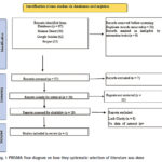
During this review was that most of research that involved the application of GIS and RS in urban sprawl monitoring seemed to be concentrated within a few countries
Mosa Koloko
Institute for Water Studies, Department of Earth Sciences, Faculty of Natural Sciences, University of the Western Cape, Private Bag X17, Bellville 7535, South Africa
Thabang Maphanga
Institute for Water …
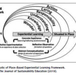
A GIS-enhanced curriculum for sustainable planning and socio-economic transformation in northern cape, South Africa
Dr. Tolulope Ayodeji Olatoye
Lecturer and Post-Doctoral Research Fellow in Geography at Sol Plaatje University, Kimberley, South Africa.
Dr. Raymond Nkwenti Fru
Head of Department, Human Science Teaching at the Faculty of Education, Sol Plaatje University, Kimberley. South Africa
Abstract
The Northern Cape province of South Africa …

AI for architecture, on this account, is less about spectacle than about the quiet, demanding work of structural diagnosis and structurally constrained generation.
Bin Jiang
LivableCityLAB, Urban Governance and Design Thrust, The Hong Kong University of Science and Technology (Guangzhou), China
Abstract
This essay argues that the most consequential question for AI in architecture is not whether AI can …

The findings of this research will provide valuable recommendations for the FCTA to implement a people- friendly land administration policy.
Okpeke, Philip Ochene
Corresponding Author, University of America, California, USA
Aransiola, Yusuf Abdullatif
University of America, California, USA
Professor Prince Michael Ikupolati
Corresponding Author, University of America, California, USA
Abstract
This study explores the critical role of development communication in promoting sustainable land …
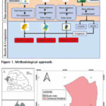
The result from the GNSS processing method achieved the best performance in terms of absolute error evaluation
Mouhamadou Moustapha Mbacké Ndour
UFR-SI, University of Iba Der Thiam, Thiès, Senegal
Papa Matar Sylla
Holding Gueye, Dakar, Senegal
Alphousseyni Ndonky
UFR-SI, University of Iba Der Thiam, Thiès, Senegal
Babacar Faye
Simon & Christiansen Afrique (S.C.A), Dakar, Senegal
Abstract
The spatial representation of the Earth’s surface, as well …

AbdelKarim Fawwaz AlBataineh
Faculty of Administrative and Financial Sciences, Department of Finance & Banking, University of Petra, Amman, Jordan
Abstract
This study explores the implementation of blockchain technology, specifically smart contracts, within the Land Registry and Survey Department to enhance sustainable development in Jordan. Utilizing a quantitative, cross-sectional survey design, the research targeted 12,450 employees of the Jordanian …

A Geospatial assessment of urban expansion suitability using multi-criteria framework
Shashi Shekhar
Scientific Officer, Himachal Pradesh State Pollution Control Board
Abstract
Rapid urbanization in fragile Himalayan ecosystems necessitates robust land-use planning that balances development needs with environmental conservation. This study utilizes a Multi-Criteria Decision Support (MCDS) system, implemented via the Weighted Linear Combination (WLC) method within the Google Earth …

Innovative solutions and applications using ChatGPT, an advanced AI language model
Fatih Taktak
Uşak University, Department of Architecture and Urban Planning, Uşak 64800, Türkiye
Uşak University, Graduate School of Education, Department of Urban Transformation, Head of Department, Uşak 64200, Turke
Abstract
This study investigates the potential of the advanced AI model, ChatGPT, in providing innovative solutions and applications within Geomatics …

The findings of this study show the potential of using UAS-lidar as a sampling tool for estimating and monitoring AGB and other forest structural attributes.
Hastings Shamaoma
Department of Urban and Regional Planning, Copperbelt University, 21692 Kitwe, Zambia.
Paxie W. Chirwa
Forest Science Postgraduate Programme, Department of Plant and Soil Sciences, University of Pretoria, Private Bag X20, Hatfield, Pretoria …