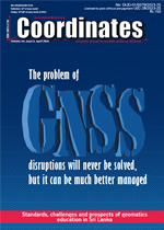
European Radionavigation Plan and the proposed EU Complementary Positioning, Navigation and Timing (C-PNT) Ecosystem Lukasz Bonenberg, Beatrice Motell a, Matteo Paonni and Joaquim Fortuny-Guasch | GNSS Constellation Specific Monthly Analysis Summary: March 2024 Narayan Dhital | Standards, challenges and prospects of geomatics education in Sri Lanka H. M. I. Prasanna and M. D. E. K. Gunathilaka | Harnessing Geospatial Insights: Understanding Himachal Pradesh’s flash flood vulnerability Shashi Shekhar and Satish Kumar Negi | Old Coordinates
 GNSS
GNSS European Radionavigation Plan and the proposed EU Complementary Positioning, Navigation and Timing (C-PNT) Ecosystem
Lukasz BonenBerg, Beatrice MoteLLa, Matteo Paonni and JoaquiM Fortuny-guasch
By establishing an EU PNT ecosystem that incorporates C-PNT technologies, we can enhance PNT resilience, availability, and continuity, thereby strengthening EU autonomy, resilience of the economy, and through technical development also EU’s global standing...... [more]
 HIS COORDINATES
"The problem of GNSS disruptions will never be solved, but it can be much better managed”
Dana A. Goward - President, Resilient Navigation & Timing Foundation
The key is to make it more difficult to disrupt GNSS, and ensure users have alternatives when it is disrupted. This will make GNSS use safer by discouraging malicious interference. And it will make users safer by ensuring they can safely weather disruptions...... [more]
 GNSS UPDATE
GNSS constellation specific monthly analysis summary:March 2024
Narayan Dhital
In this month’s issue, there is an additional monitoring of the satellite Timing Group Delay (TGD)/Broadcast Group Delay (BGD) parameters. The regular analysis of Earth Rotation Parameters (ERPs) and satellite attitude dynamics is omitted in this month’s issue and will be covered again in coming months.... [more]
 EDUCATION
Standards, challenges and prospects of geomatics education in Sri Lanka
H. M. I. Prasanna and M. D. E. K. GunathiLaka
With the evolvement of new technologies and new opportunities enabled surveyors to broaden their skills and competencies than they were traditionally involved as the surveying profession moves into the 21st century. These led to several challenges in defining the boundary of the profession..... [more]
 DISASTER MANAGEMENT
 Harnessing Geospatial Insights: Understanding Himachal Pradesh’s flash flood vulnerability
Shashi Shekhar and Satish Kumar Negi
The paper aims to analyse the natural disaster that struck the State of Himachal Pradesh in 2023, resulting in significant losses to human life, property, and infrastructure due to flash floods triggered by heavy rainfall from July to September 2023..... [more]
Inertial Labs enhances INS solutions
Quectel unveils 5G and GNSS antennas
Saildrone launches the first unmanned surface vehicle
CMC Electronics and Hexagon partner for GNSS innovation
Iridium Agrees To Buy GNSS Protector Satelles
Enhancing timing synchronisation for enterprise applications
Cognni revolutionizes data mapping
FrontierSI urges action on resilient PNT infrastructure
ESA kicks off two new navigation missions
$4 billion investment in Anthropic by Amazon
NYC autonomous vehicle testing program
NV5 acquires GIS Solution
Gatwick Airport establishes new geospatial platform
Ocean floor a ‘reservoir’ for plastic pollution
Melting ice, an expanding phenomenon
NOAA awards Small Business Innovation Research Program Grant to Hydrosat
China launches new remote sensing satellite
Unlocking clearer views of our world’s water: A Landsat legacy
Remote sensing data can reduce the bias in Arctic melt estimates by up to 70%

