Volume 22, Issue 6, June 2026 |
|
||||||||||||||||||||||||||||||||||
|
||||||||||||||||||||||||||||||||||
Volume 22, Issue 5, May 2026 |
|
||||||||||||||||||||||||
SBG Systems has announced the Pulse-40 Inertial Measurement Unit. This tactical-grade IMU offers unmatched performance in harsh conditions in a miniaturized size for applications where precision and robustness matter in all conditions.
SBG Systems has a long-term history of designing best-in-class MEMS-based Inertial Navigation Systems. At the core of our INS, extensive research in signal processing, …
Applanix, a Trimble Company (NASDAQ: TRMB), has announced the Trimble® AP+ Land GNSS-inertial OEM solution for accurate and robust position and orientation for georeferencing sensors and positioning vehicles in land mobile mapping applications. This enables users to accurately and efficiently track and monitor fleets, produce high-definition (HD) maps and 3D models, or act as a …
C-V2X is one of the most significant automotive developments, and the creation of the appropriate standards and testing procedures to ensure compliance has become the key to this technology. Vehicle OEMs and Tier1 component suppliers need a standard system to support and guide the development and research of their C-V2X products and function of the …
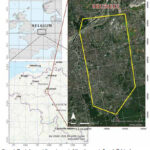
Currently, the worsening impacts of urbanizations have been impelled to the importance of monitoring and management of existing urban trees, securing sustainable use of the available green spaces.

The effectiveness of programmes realizing urban equity and resilience in the South African context are greatly constrained by South Africa’s entrenched racial, (and through that class) land ownership and settlement patterns. Given the costs of well-located urban land, the state efforts to house the urban poor have often resulted in housing opportunities…


 |
Introduction To Geodesy... |
 |
This comprehensive book charts the course of NSDI journey in India, which is still continuing... |
 |
“The problem of GNSS disruptions will never be solved, but it can be much better managed”
Dana A. Goward |


 (5.00 out of 5) (5.00 out of 5) (5.00 out of 5) (5.00 out of 5)
