Volume 22, Issue 5, May 2026 |
|
|||||||||||||||||||||||||||||||||||||
|
|||||||||||||||||||||||||||||||||||||
Volume 22, Issue 4, April 2026 |
|
|||||||||||||||||||||
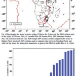
This study provides for the entire continent of Africa the position/ velocity solution precisely expressed with reference frame IGSR3
Saturday E Usifoh
GFZ German Research Centre for Geosciences, Potsdam, Germany Institut für Geodäsie und Geoinformationstechnik Technische Universität, Berlin, Germany Centre for Geodesy and Geodynamics, Toro, Bauchi State, Nigeria
Benjamin Männel
GFZ German Research Centre for Geosciences, Potsdam, Germany
Pierre Sakic
GFZ …

We give an example of a straight forward procedure tailored to understand and question the effects of different error components in both SIS domain and the position domain
Adrià Rovira-Garcia
Research group of Astronomy and Geomatics, Universitat Politècnica de Catalunya, Spain Corresponding author: Universitat Politecnica de Catalunya, Spain, adria.rovira@upc.edu
Deimos Ibáñez-Segura
Research group of Astronomy and Geomatics, Universitat Politècnica …
Omnispace and Ligado Networks announced a Memorandum of Understanding (MOU) to combine their respective licensed mobile satellite services (MSS) spectrum to enable the world’s most capable space-based, direct-to-device (D2D) solutions for global voice, text and data connectivity.
Utilizing large blocks of satellite spectrum in the L- and S-Bands, this agreement sets the stage for the development of multi-band, …
The Belgian solid-state Lithium battery technology company, SOLiTHOR and the leading aerospace company, Sonaca, have signed a bilateral Memorandum of Understanding to go into partnership where they will jointly develop safe, high-density rechargeable solid-state Lithium battery systems for Regional Aircraft and Urban Air Mobility. This partnership will also expand to Satellite systems as well as …
Thales and LuxCarta, a company specialized in the production of geospatial products derived from satellite imagery, join forces to offer artificial intelligence (AI) enhanced solutions for intelligence and military cartography. This agreement reinforces the partnership between the two companies, which have been working together since 2020.
To quickly obtain accurate geospatial data is critical to military …


 |
Introduction To Geodesy... |
 |
This comprehensive book charts the course of NSDI journey in India, which is still continuing... |
 |
“The problem of GNSS disruptions will never be solved, but it can be much better managed”
Dana A. Goward |


 (5.00 out of 5) (5.00 out of 5) (5.00 out of 5) (5.00 out of 5)
