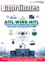
Volume 22, Issue 6, June 2026 |
|
||||||||||||||||||||||||||||||||||
|
||||||||||||||||||||||||||||||||||
Volume 22, Issue 5, May 2026 |
|
||||||||||||||||||||||||
A Geospatial assessment of urban expansion suitability using multi-criteria framework
Shashi Shekhar
Scientific Officer, Himachal Pradesh State Pollution Control Board
Abstract
Rapid urbanization in fragile Himalayan ecosystems necessitates robust land-use planning that balances development needs with environmental conservation. This study utilizes a Multi-Criteria Decision Support (MCDS) system, implemented via the Weighted Linear Combination (WLC) method within the Google Earth Engine (GEE) cloud computing platform, to delineate and quantify optimal areas for urban expansion around the Shimla region, Himachal Pradesh, India. Five critical factors—Slope, Land Use/Land Cover (LULC), Aspect, Road Proximity, and Geology—were integrated after …
Each procedure for static, PPK and RTK has its own advantages and short falls.
Siba Prasad Mishra
Siba Prasad Mishra Professor, Civil Engineering Department, Geoinformatics, Centurion University of Technology and Management, Odisha, India
Kamal Kumar Barik
Associate Professor and Head, Geoinformatics Wing, Geoinformatics, Centurion University of Technology and Management, Odisha, India
Mr Rabindranath Nanda
Ex- Superintending Surveyor, Survey of India, presently working at National Spatial Infrastructure, New Delhi, India
Kumar Chandra Sethi
Ex-Officer Surveyor, Survey of India, presently working as Adjunct Professor. Centurion University of Technology in Management, Jatni, Bhubaneswar, Odisha
Abstract
The Differential Global Positioning System (DGNSS), have three …
The analysis performed in this report is solely his work and own opinion.
Narayan Dhital
Actively involved to support international collaboration in GNSS related activities. He has regularly supported and contributed to different workshops of the International Committee on GNSS (ICG), and the United Nations Office for Outer Space Affairs (UNOOSA). As a professional employee, the author is working as GNSS expert at the Galileo Control Center, DLR GfR mbH, Germany
Introduction
This article continues the monthly performance analysis of the GNSS constellation. Readers are encouraged to refer to previous issues for foundational discussions …
If we want real time “geo intelligent” agents, we must confront the gap between elegant demos and messy, dynamic reality.
Nirmalendu Kumar
Additional Surveyor General, Survey of India (Retd) Managed Mapping and Surveying Operations for whole southern India
Agentic AI is about to collide with geospatial intelligence in a way that may fundamentally change how we sense, predict, and act in space and time. However, the research proves reality rarely matches hype. If we want real time “geo intelligent” agents, …
Innovative solutions and applications using ChatGPT, an advanced AI language model
Fatih Taktak
Uşak University, Department of Architecture and Urban Planning, Uşak 64800, Türkiye
Uşak University, Graduate School of Education, Department of Urban Transformation, Head of Department, Uşak 64200, Turke
Abstract
This study investigates the potential of the advanced AI model, ChatGPT, in providing innovative solutions and applications within Geomatics Engineering. ChatGPT enhances data accuracy, improves process efficiency, and supports project management by analyzing large geospatial datasets and interpreting complex information. It offers significant benefits to professionals and students, such as automating routine tasks, providing …


 |
Introduction To Geodesy... |
 |
This comprehensive book charts the course of NSDI journey in India, which is still continuing... |
 |
“The problem of GNSS disruptions will never be solved, but it can be much better managed”
Dana A. Goward |