Articles in the Articles Category
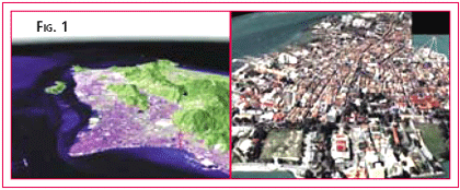
Spatial data is the fuel for 3D Applications, but all too often the fuel supplied is inappropriate. The software applied and expertise required when modelling a flood event or predicting a cityscape’s lineof-site is exactly the same using highly precise data as it is for generalised data. The difference is in how well that analysis relates to the real world … i.e. whether the analysis is correct or not. Conversely, supplying highly accurate or dense data to a generalised analysis can cost both time and money which is not reflected in the final product. Hence the word of this paper is: appropriate. Apply the most appropriate data to your application. There is nothing wrong with “approximate” or “inexpensive” 3D data, as long as it is appropriate for the level of analysis being performed.
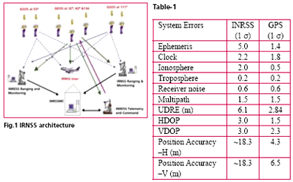
Indian Space Research Organisation (ISRO) has taken up a project called Indian Regional Navigation Satellite System (IRNSS) for the establishment of an independent regional navigational infrastructure. The system main objective is to provide high positional accuracy (comparable to the existing constellations) real time position, velocity and time for various users in the region. IRNSS services will be available on a 24x7x365 basis irrespective of the availability of other constellations over Indian airspace. The system leverages the technological competence of ISRO in satellite, ground and other critical technologies
Dr Manmohan Singh, Prime Minister of India has recently expressed concern over the ‘decline …
“Create synergy between the science and application of …

To carry out the infrastructural development in any area, topographical maps (accurate, reliable and updated) of that area are of vital important. Topographic maps are also important aids for administrative and strategic planning, disaster mitigation, socioeconomic development and other related activities. In order to prepare topographic map, it is prerequisite to have grid coordinates as well as elevations of control points.






 (5.00 out of 5)