Articles in the Articles Category

Second ESRI Asia-Pacific User Conference, 18-19 January, 2007, New Delhi, India
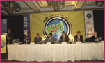
The Second ESRI Asia-Pacific User Conference under the theme of “GIS for economic development” was held at Hotel Taj Palace, New Delhi, India on January 18-19. Organized by ESRI India, the event witnessed participation from more than 900 …

Navigare Necesse Est is the Latin tag that underpins the basic necessity of all forms of life to fi nd their way to survive and prosper. Today’s new world of ubiquitous electronic navigation supremely illustrates that dictum. Says Dick Smith, newly elected President of the International Association of Institutes of Navigation (IAIN)
Would you …

Jack Dangermond shares his observations with Coordinates
Challenges that Coordinates should focus on
A big challenge is integrating the surveying profession with the GIS profession. There’s a growing tension between them. One of the bridges that I want to accomplish this year is integrating the technology so the surveyors can have tools within …

Prof Dr Güenter W Hein, Director of the Institute of Geodesy and Navigation, University FAF, Munich, on GNSS trends, applications and challenges
Please tell us about the focus of research at your Institute.
The Institute of Geodesy and Navigation of the University FAF Munich with presently more than 30 research associates from various …
April 2007
63rd Annual Meeting, Featuring New Bio Navigation Workshops
April 23-25, 2007, Cambridge, MA
www.ion.org
2nd National GIS Symposium in Saudi Arabia
23-25April, 2007 Al-Khobar, Saudi Arabia
info@saudigis.org
http://www.saudigis.org/
May 2007
TimeNav’07 – ENC-GNSS 07
29 May – 1 June 2007
Geneva International Conference Center,Switzerland
Spatial Sciences Institute Biennial International Conference
14-18 May, Hobart, Tasmania, Australia
www.ssc2007.com
Intergraph 2007
21-24 May, Nashville, Tennessee, USA
http://www.intergraph2007.com
International Conference on …

Over the years topographic mapping generally involved acquisition of data related to the features of the earth, its environs of user’s interest and its graphic depiction on a suitable media, generally paper, ensuring that the accuracy specifications, which depend upon the type of end product, are strictly adhered to.
Over the years topographic mapping generally involved acquisition of data related to the features of the earth, its environs of user’s interest and its graphic depiction on a suitable media, generally paper, ensuring that the accuracy specifications, which depend upon the type of end product, are strictly adhered to.

Global Navigation Satellite System (GNSS) consists of GPS, GLONASS and Galileo which is still under construction by the European Union. GPS is the most widespread GNSS in the world and applies successfully in so many fields such as positioning, navigation, geodesy, mapping, timing and so on. However, GLONASS has not done its work well for about ten years because of lack of funds. In summer of 2006, Russia’s GLONASS program continued its comeback and will have a full 24-satellite constellation by the end of 2009. Notably, China has a regional RDSS system using three geostationary satellites since 2000.
INS is a self-contained positioning and attitude device. In other words, it meets the all-environment requirement. The primary advantage of using INS is that velocity and position of the vehicle can be provided with abundant dynamic information and excellent short term performance. The main shortcoming is that the INS accuracy degrades greatly over time.
OnFinally, Google agreed.
Agreed to blur the pictures of sensitive Indian establishments.
Recently, Google Earth shocked many.
Many took the development as the deathblow to the issues like
“non-accessibility/non-availability of spatial information”.
However, many got worried, more than ever before,
about the security implications.
The issue was more important as many contended that “such
exposures” were selective in nature and not for all …
February 2007
Integrated Water Resource Management- (IWRM-2007)
5-7 February, Banglore, India
www.angelfire.com/planet/kerf/
Geomatica 2007: Geomatics …

As part of the 17th United Nations Regional Cartographic Conference for Asia and the Pacific (UNRCC-AP) held in Thailand in September 2006, Working Group 3 of the Permanent Committee for GIS Infrastructure for Asia and the Pacifi c (PCGIAP) organised a one-day international workshop (21st September 2006) on the‘Integration of Built and Natural Environmental Datasets within National SDI Initiatives’. The workshop was conducted with the support of the Centre for Spatial Data Infrastructures and Land Administration, the University of Melbourne.


 (5.00 out of 5)