Articles in the Articles Category


although distribution mechanisms and types of products available may change
IMTA claims to be “the voice of the industry worldwide”. Please comment.
The IMTA was established over 25 …
A review on one of the most famous european satnav symposia
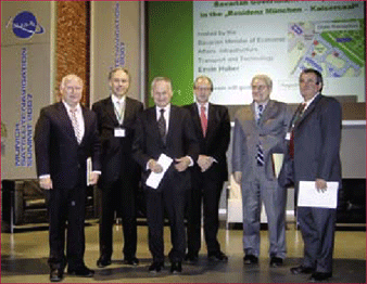
The Munich Satellite Navigation Summit (MSNS) 2007 closed on March, 8th – about 400 guests from 28 nations left Munich after three days conferencing. In the run-up of the MSNS the conference advertised with the words: High quality, …
April 2007
63rd Annual Meeting, Featuring New Bio Navigation Workshops
April 23-25, 2007, Cambridge, MA
www.ion.org
2nd National GIS Symposium in Saudi Arabia
23-25April, 2007 Al-Khobar, Saudi Arabia
info@saudigis.org
http://www.saudigis.org/
May 2007
TimeNav’07 – ENC-GNSS 07
29 May – 1 June 2007
Geneva International Conference Center,Switzerland
Spatial Sciences Institute Biennial International Conference
14-18 May, Hobart, Tasmania, Australia
www.ssc2007.com
Intergraph 2007
21-24 May, Nashville, Tennessee, USA
http://www.intergraph2007.com
International Conference on Integrated …

Sustainability is the key issue in forest management, be it India, or any other part of the globe. Unfortunately, so far, no scientifi cally sound and operational defi nition of Sustainability has been evolved for universal application in forest management. Nevertheless, it may be said on an empirical basis that sustainable forest management lies in attaining three basic goals: fi rst, maintaining the stability of the physical environment, secondly, maintaining, and if necessary increasing, the biological productivity of the resource, and thirdly, establishing equity in distribution of qualitative and quantitative benefi ts generated by the resource in the society dependent on it. The goals are to be attained not at any chosen point of time, but in perpetuity. Sustainable forest management is a multidimensional process. The major dimensions of the process are: ecological, silvicultural, technical (including the disciplines of genetics and biotechnology), socio-economic, and institutional. All the dimensions are equally important and neglect of any can mar the Sustainability of the process.
There is news.
That too a good one.
Reportedly, all 4,800 maps of the Survey of India will be available in public domain.
As many as 2,900 are of open series.
It would happen by March end.
The commitment(!) comes from the Minister himself. The Minister of Science and Technology, Government of India.
It looks like actualization …

Second ESRI Asia-Pacific User Conference, 18-19 January, 2007, New Delhi, India
The Second ESRI Asia-Pacific User Conference under the theme of “GIS for economic development” was held at Hotel Taj Palace, New Delhi, India on January 18-19. Organized by ESRI India, the event witnessed participation from more than 900 …

Navigare Necesse Est is the Latin tag that underpins the basic necessity of all forms of life to fi nd their way to survive and prosper. Today’s new world of ubiquitous electronic navigation supremely illustrates that dictum. Says Dick Smith, newly elected President of the International Association of Institutes of Navigation (IAIN)
Would you …

Jack Dangermond shares his observations with Coordinates
Challenges that Coordinates should focus on
A big challenge is integrating the surveying profession with the GIS profession. There’s a growing tension between them. One of the bridges that I want to accomplish this year is integrating the technology so the surveyors can have tools within …

Prof Dr Güenter W Hein, Director of the Institute of Geodesy and Navigation, University FAF, Munich, on GNSS trends, applications and challenges
Please tell us about the focus of research at your Institute.
The Institute of Geodesy and Navigation of the University FAF Munich with presently more than 30 research associates from various …
April 2007
63rd Annual Meeting, Featuring New Bio Navigation Workshops
April 23-25, 2007, Cambridge, MA
www.ion.org
2nd National GIS Symposium in Saudi Arabia
23-25April, 2007 Al-Khobar, Saudi Arabia
info@saudigis.org
http://www.saudigis.org/
May 2007
TimeNav’07 – ENC-GNSS 07
29 May – 1 June 2007
Geneva International Conference Center,Switzerland
Spatial Sciences Institute Biennial International Conference
14-18 May, Hobart, Tasmania, Australia
www.ssc2007.com
Intergraph 2007
21-24 May, Nashville, Tennessee, USA
http://www.intergraph2007.com
International Conference on …


 (5.00 out of 5)