Articles in the Articles Category

The generalized orthogonalization does not require the formation of the normal equations and is therefore numerically more stable than the conventional method
Prof. Joël van Cranenbroeck
Managing Director CGEOS Creative Geosensing SPRL Belgium
Abstract
The purpose of this article is to present a resolution method to the users of the least squares …

Recently, an Immarsat led team of companies in the UK
Began the broadcasting satellite navigation signal.
This was done in coordination with the U.S. Federal Aviation Administration (FAA), the European Space Agency (ESA) and the European Union Space Programme Agency (EUSPA).
And was intended to explore the national capability in resilient PNT.
The …
September 2022
International Symposium of Commission 4: Positioning and Applications
5 to 8 September 2022
www.iag-commission4-symposium2022.net
15th Conference on Spatial Information Theory (COSIT)
5-9 Sep 2022 Kobe, Japan
cosit2022.iniad.org
Commercial UAV Expo Americas
6-8 September 2022 Las Vegas, USA
www.expouav.com
17th Symposium on Location Based Services (LBS2022)
12-14 Sep 2022 Munich, Germany
lbsconference.org
18th International Conference on Geoinformation and Cartography
14-16 Sep 2022 Zagreb, Croatia
www.kartografija.hr
EuroCarto 2022
19-21 Sep Vienna, Austria
www.eurocarto2022.org
ION …

The first of the few glimpses,
Seizing the moments of cosmic history
Captured by the James Webb Space Telescope
Have been released.
The first image depicts SMACS 0723,
According to NASA is
“the deepest and sharpest infrared image of distant universe to date”.
This takes us to the world of stars and galaxies,
Never seen …
August 2022
GeoCart’2022
24 – 26 Aug Wellington, New Zealand
https://www.cartography.org.nz
September 2022
International Symposium of Commission 4: Positioning and Applications
5 to 8 September 2022
www.iag-commission4-symposium2022.net
15th Conference on Spatial Information Theory (COSIT)
5-9 Sep 2022 Kobe, Japan
cosit2022.iniad.org
Commercial UAV Expo Americas
6-8 September 2022 Las Vegas, USA
www.expouav.com
17th Symposium on Location Based Services (LBS2022)
12-14 Sep 2022 Munich, Germany
lbsconference.org
18th International Conference on Geoinformation and Cartography
14-16 Sep …

Nine determining parameters identified in this study to identify suitable site for the industrial establishment
Muluneh Beyene Tsala
Department of Land and Real Property Valuation, Dire Dawa University, Ethiopia
Abstract
The significance of GIS and Remote Sensing techniques and technologies currently in every aspect of human beings day-to-day activities initiated the researcher to conduct this study. Industry is important …

The paper proposes an approach using a distributed ledger (blockchain) besides a configuable IoT-based system to take into account all needed data including specific case of urban area
Marouane El Midaoui
Signals, Distributed Systems and Artificial Intelligence ENSET Mohammedia, University Hassan II OF Casablanca, Morocco
El Mehdi Ben Laoula
Signals, Distributed Systems and Artificial Intelligence ENSET Mohammedia, University Hassan …

The EN16803 series of standards is designed to help users make better choices and simplify the integration of satellite technologies into onboard systems
Xavier Leblan
GUIDE-GNSS, Toulouse, France
Giuseppe ROTONDO
GUIDE-GNSS, Toulouse, France
Miguel Ortiz
Université Gustave Eiffel, Nantes, France
Christelle Dulery
CNES (French Space Agency), Toulouse, France
Abstract
The geolocation field has acquired a reference methodology that is essential for evaluating and characterizing …

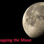
In 2020, it was USGS Astrogeology Science Centre
That released “Unified Geologic Map of the Moon” (1:5,000,000 scale).
Now China has released comprehensive geologic map of the moon
The most detailed one (1:2,500,000 scale).
This is the result of the efforts many Chinese scientists from several institutions,
Who have developed high-resolution topographic maps
Largely from …
June 2022
ISPRS Congress 2022
6-11 June Nice, France
https://www.isprs2020-nice.com
8th International Conference on Cartography and GIS
20 to 25 June 2022 Nessebar, Bulgaria
https://iccgis2020.cartography-gis.com
July 2022
IGARSS 2022 (hybrid form)
17-22 July 2022 Kuala Lumpur, Malaysia
https://igarss2022.org
August 2022
GeoCart’2022
24 – 26 Aug Wellington, New Zealand
https://www.cartography.org.nz
September 2022
15th Conference on Spatial Information Theory (COSIT)
5-9 Sep 2022 Kobe, Japan
cosit2022.iniad.org
Commercial UAV Expo Americas
6-8 September 2022 Las Vegas, USA
www.expouav.com
17th Symposium …


 (5.00 out of 5)