Articles in the Articles Category


It has been a journey
From apprehensions to aspirations,
Enthusiasm to endurance,
Potential to performance.
It is not about desires
But more of deliverables.

Galileo is Europe’s contribution to the multi-GNSS to provide a highly accurate, guaranteed global positioning service under civilian control. Offering dual frequencies as standard, Galileo is expected to deliver extremely good realtime positioning accuracy. From users’ point of view, availability of Galileo’s signal would help in achieving a multi- GNSS environment for redundancy and system independence.

The International Maritime Organisation (IMO) is developing e-Navigation as the future approach to marine navigation in order to enhance maritime safety. As such, the IMO state that positioning systems for e-Navigation “should be resilient …. robust, reliable and dependable. Requirements for redundancy, particularly in relation to position fixing systems should be considered”

In recent years there has been an explosion in the sporting world in the use of GPS. You will scarcely see a runner or cyclist on the road without either a smartphone strapped to their arm, or a dedicated GPS device clamped to their handlebars, tracking their every move. The amount of information that the modern sportsperson – from casual amateurs to full time professionals – is logging, analysing, and sharing is phenomenal. There are now dozens of ways of uploading data for the whole world to share and study.

Most applied methods to determine the tourism demand depend on the availability of demographic data, social and economic characteristics of tourists, tourism customs, the quality of tourist activities and facilities, and other foundations such as the capacity of the tourist destination, and its accessibility…

With over 250 attendees from 40 countries, the RIEGL LIDAR 2013 International Airborne, Mobile, Terrestrial & Industrial User Conference turned out to be the LIDAR event of the year.
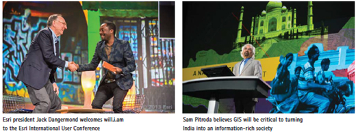
that’s what happened at the 2013 Esri International User Conference (Esri UC) in San Diego, California. It’s where will.i.am, the recording artist and founder of the Black Eyed Peas, helped Katherine O’Brien, GIS coordinator for facilities at the University of North Carolina (UNC)

Uttarakhand is in absolute shambles. Disaster, with most people calling it more manmade than natural, has exposed the fragility of this beautiful yet ecologically vulnerable region. Untold and unimaginable damage has been done with surging rivers and flash floods bringing…

This section presents the structure of a mobile field robot, including a robotic base and an embedded circuit board design.

In order to solve the underlying problem, Korea MOLIT (Ministry of Land, Infrastructure and Transport) enacted a special act on cadastral resurvey, proclaimed this on 16 September 2011. With the implementation of this special act from 17 March 2012, a CRP (Cadastral Renovation Project) has been being promoted in earnest.


 (5.00 out of 5)