Articles in the Articles Category


Most of today’s Location Based Services (LBS) provide information based solely on a users’ location, not taking into account context knowledge about the user’s current situation and needs. This often results in low-quality and inappropriate information to the user. Hence, in order to provide user-oriented services, an improvement of the response-quality of information requests is required. Knowledge about the coordinates of places where the user regularly stays in her life combined with semantics about such places can provide valuable knowledge for LBS. Zhou et al.

Predictions and surveys indicate a boom in LBS.
All across the world.
Maybe at different pace at different places.
And, might be in different stages.
…

Nehru Yuva Kendra Sangathan (NYKS) , an autonomous agency under Ministry of Youth Affairs and Sports has the bounden duty to achieve the objectives laid down in the National Youth Policy. The advancement in the field of Science and Technology should be made available to the youth and to the community. As the adaptation of scientific and technological principles and developments, to maximize the use of local resources, are central to empowerment in the quality of life, the Policy recognizes the importance of emerging, modern technologies, particularly in the field of information technology and electronic media, in enabling the youth to perform and achieve in all sectors of their interest.

GPs is running since more than a decade. There are user groups in all domains relying on the provided information. GPS is even used in safety critical environment, but there have been no certification of the GPS system nor are there any plans to do so. Within aviation, GPS is assumed to fulfill requirement on reliability and availability based on observations of the past. Is the discussion in Europe about certification of the Galileo SIS (Signal in Space) just another proof for the bureaucratic overhead imposed on the Galileo project? NavCert as part of the TÜV SÜD group is focused on certification in the area of positioning and navigation.
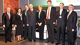
Opening Plenary in Allerheiligen Hofkirche
This year more nations than ever before participated in the Munich Satellite Navigation Summit 2008 which was held from February 19th to 21st in Munich, Germany. Organizer Prof. Guenter W. Hein of the Institute of Geodesy and Navigation of the University FAF Munich welcomed 400 guests from …
May 2008
IEEE/ION PLANS 2007
Co-sponsored by IEEE and
Institute of Navigation
May 5-8, 2007
Monterey, California, USA
http://www.plansconference.org
June 2008
International conference: “Studying, Modeling and Sense Making of Planet Earth”
1 – 6 June, 2008
Department of Geography,
University of …

Positioning by GPS can be derived today with a precision of a few millimeters. A GPS receiver determines the distance between the electrical phase center of its antenna and the phase center of a GPS satellite’s transmitting antenna as a pseudorange or a carrier phase observation. It is well known that the phase center of the antenna is not a stable point.

How would the world look like if you were standing on an arbitrary point on earth? It is not easy to imagine, how a randomly chosen location would look like since most pictures that come into our mind are somewhat special: our home, Piccadilly Square, a picture from National Geographic, or a photo that had been taken on top of a famous summit.

Many intelligent people into IT jobs in India are below their intellectual capabilities…
They are like coolies who are working for wages …

Filipo Rodriguez, Gian Paolo Plaia
Application of cognitive psychology for reduction of mapping errors
Human factors contributing to mapping errors made by operators working on digital mapping systems were studied from Cognitive Psychology perspective to evolve suitable strategies to reduce errors.
Mapping errors
Study area
Large scale topographic maps of better than 1:5000 scale with 1 to 2 m contours are …


 (5.00 out of 5)