Articles in the Mycoordinates Category

Mission Possible
It is a seamless backup to GPS. {Paragraph} {Also please check there must be good enough line spacing}
It is cost-effective and completely interoperable.
Asserts The Independent Assessment Team (IAT).
Also, recommends unanimously to US Government.
To complete the eLoran upgrade and commit it as the national backup to GPS.
Two …
On Feb 10, 2009 two communication satellites collided in space.
It happened over Northern Siberia, 490 miles above the earth surface.
The low-earth orbit (LEO) location of the collision …
A group of Japanese professionals and lawyers have asked Google to
stop providing the detailed street level images of Japanese cities.
Their concern is that it violates privacy rights.
The ‘owners of the technology’ tend to demonstrate the extent
to which the technology can go and what …
Economic slowdown, meltdown, recession…
Cost cut, retrenchments, …
Fears, uncertainty, survival issue…
Is geomatics industry immune?
No, if we talk about banking, retail or auto segments…
To an extent yes, if we think about government-driven infrastructure projects.
Defence, internal security, …
Appears, we are heading towards diffi cult times.
It is also a time to correct fundamentals.
Focus on forgotten sectors like agriculture.
…

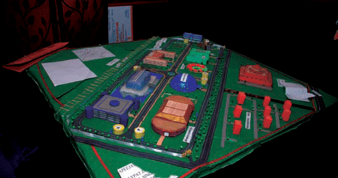
The competition started nearly two decades ago in the United States as the National Engineers Week Future City Competition with the aim to provide fun and exciting educational engineering programs for school students by combining stimulating engineering challenges with ‘hand-on’ application to enable them to present their vision of a city of the future…
India witnesses another onslaught of brutality, helplessly.
A country of more than a billion, the world’s largest democracy, the rising Asian space power, nuclear power… was held to ransom.
For more than 60 hours.
By a small, but heavily armed, well-trained and highly motivated group.
An execution of meticulous planning, using advanced technologies like digital maps, satellite …
The moon mission of India.
A display of technological prowess.
And willingness.
On November 4, Chandrayaan-1 …


 (5.00 out of 5)