

Global Mapper v22.1
Blue Marble Geographics has released version 22.1 of Global Mapper. The version 22.1 release includes several enhancements to the software’s 3D Viewer including, a new ‘Save 3D Views’ function and 3D View navigation tools to target the camera on specific features and lock the pivot axis around a feature of interest. The …
NASA advancing GNSS capabilities
NASA is developing capabilities that will allow missions at high altitudes to take advantage of signals from Global Navigation Satellite System (GNSS) constellations — like GPS commonly used in the U.S. These signals — used on Earth for navigation and critical timing applications — could provide NASA’s Artemis missions to the Moon …
Location information is an integral part of the modern digital ecosystem and critical for unlocking economic, social and environmental opportunities for sustainable growth and development of the country…

The development of the modern Greek cadaster has been a long standing objective for every Greek government since the early 19th century in order to replace the existing oldfashioned individual based system…

Modern cities and urban environments are becoming denser more heavily populated and are still rapidly growing, including new infrastructures, markets, banks, transportation, etc. In the last two decades, more and more cities and mega-cities have started using multi-camera networks in order to face this challenge.

This paper examines the spatial and temporal distribution of all COVID-19 cases from January to June 2020 against the underlying distribution of population in the United States. It is found that, as time passes, COVID-19 cases become a power law with cutoff, resembling the underlying spatial distribution of populations…
Volume XVII, Issue 1, January 2021
The Importance of being resilient: Challenges with GNSS in COVID-19 times
John Fischer
The COVID-19 pandemic sheds light on our dependence on PNT services
Guy Buesnel
Digital Twin – Industrial navigation Avatars for cooperative multimachine automation
Graeme Hooper
C++ programming for cartography and geodesy students
V R Zablotskii
COVID-19 – Geo-spatial big data analysis
Arun Kumar Verma, Anjul Verma …
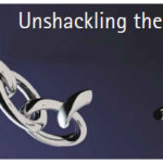
When WhatsApp recently proposed certain changes in their privacy policy in certain parts of the world,
There was an outrage.
And this further has triggered a rush to the possible alternatives, which are just a few.
What purported as empowering,
Technology has entrenched deep in our lives.
And worse, has enslaved us. What we do, what we eat, where we …
$400,000 grant for precision irrigation improvements
Viridix, an Israeli precision irrigation company, has received a $400,000 grant from the Israel Innovation Authority to enhance the remote sensing and AI capabilities of its RooTense® solution. This solution can increase crop yields by 20% while reducing water and fertilizer usage up to 50%. The Authority›s grant funds …


 (5.00 out of 5)