
Articles in the GNSS News Category


Galileo HAS ready to increase efficiency of farming tasks
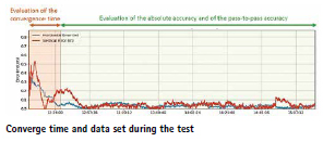
In a collaboration between the European GNSS Service Centre (GSC) of EUSPA, Hemisphere GNSS and Case New Holland, experts from all entities tested the Galileo HAS service to assess its suitability for precision agriculture applications. The working width used for the test was 2.55 m, while the …
Focal Point and STMicroelectronics partnership
FocalPoint, UK has entered into a commercial agreement with STMicroelectronics. Both the companies have now advanced their joint S-GNSS® Auto and Teseo solution to a full commercial offering. The joint industry-leading solution is delivered as a simple firmware upgrade to Teseo devices. focalpointpositioning.com
NautelNav participates in deployable eLoran concept
NautelNav …
Galileo signal updated for internet-of-things use
The European Space Agency and its industrial partners have developed a solution targeted at mass-market applications that require low power: E5a-QP, a Quasi-Pilot (QP) signal component transmitted in Galileo’s E5 band. The signal component is broadcast free of charge and now available for implementation in both new and upgraded …

Measuring water levels with cm-level accuracy using GNSS-IR
Researchers at the Institute of Geodesy and Geoinformation at the University of Bonn, led by Dr. Makan Karegar, have transferred water -level monitoring technology from the Rhine to Africa, Australia, and the Philippines as part of ESA projects. Originally developed in the DFG Collaborative Research Center SFB 1502 …
EASA and EUROCONTROL publish joint Action Plan
The European Union Aviation Safety Agency (EASA) and EUROCONTROL published a joint Action Plan designed to strengthen the safety and resilience of European aviation operations amid the growing challenge of GNSS interference.
Key Elements of the Joint Action Plan
Through joint monitoring and data-sharing, EASA and EUROCONTROL aim …
Navigation with Indian Constellation is down!
India’s indigenous satellite navigation system, Navigation with Indian Constellation (NavIC), is facing scrutiny after reports that an atomic clock onboard one of its satellites has stopped functioning, raising concerns about the reliability of the country’s homegrown positioning network.
“IRNSS-1F satellite, launched …
UK invests in satellite timing to boost national PNT resilience
GMV is leading the development of a secure two-way satellite time and frequency transfer system under the European Space Agency’s TOUCAN Project – the two way satellite time and frequency transfer capability demonstration (TWSTFT).
The initiative safeguards critical infrastructure …
GNSS and PNT security deployed at World Economic Forum
Dimetor is providing its NAVSentry airspace situational awareness system to the World Economic Forum annual meeting, in support of the Austrian Armed Forces. The meeting is taking place this week in Davos, Switzerland, close to the Austrian border. NAVSentry is an AI-powered platform for detecting GNSS disruptions …
Study on GNSS authentication and security improvements
The E-GIANTS (European GNSS Improved Authentication Solutions) project was commissioned by the European Commission and technically supervised by EUSPA. The project responds to the growing threat posed by quantum computing to traditional cryptographic methods, which could compromise the security of GNSS services in the coming decade. The study highlights …

Sixth GLONASS-K satellite lifts off
The liftoff of the Soyuz 2-1b/Fregat rocket with the sixth GLONASS-K satellite took place as scheduled on Sept. 13, 2025, from Site 43 in Plesetsk. Around five hours after the launch, the Ministry of Defense reported that both payloads had been delivered into …