

Volume 22, Issue 6, June 2026
AITL-WING-HITL: Telemanipulation of autonomous drones using Digital Twins of aerial traffic interfaced With WING
Kaya Kuru, Sam Worthington, Darren Ansell, John M. Pinder, Aadithya Sujit, Benjamin J. Watkinson, Keith
Vinning , Lee Moore, Chris Gilbert, David Jones and Claire Tinker-Mill
Development Communication in Sustainable Land Administration Practices in the Federal Capital territory (FCT) …
July 2026
XXV ISPRS Congress
4 – 11 July 2026
Toronto, Canada
www.isprs2026toronto.com/
Esri User Conference 2026
13 – 17, July
San Diego USA
www.esri.com
August 2026
13th IGRSM Conference 2026
05 – 06 August
Kuala Lumpur, Malaysia
https://conferences.igrsm.org/
September 2026
Esri India User Conference
2 – 3 September 2026
…
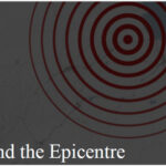
The images from the Venezuela earthquake are heartbreaking.
Collapsed homes, frantic searches through rubble, grieving families, and lives transformed in moments.
Every calamity reminds us how fragile human existence truly is.
Nature neither negotiates nor discriminates.
Its forces remain beyond human control.
Each time the Earth trembles,
We watch helplessly as lives are upended and …
SPH Engineering Launches UgCS 6.0
SPH Engineering has released UgCS 6.0, a major update designed to resolve critical operational bottlenecks in large-scale drone surveying. The software’s new “Large Projects” feature allows operators to import massive polygons and easily split them into smaller sub-areas while guaranteeing perfect grid alignment across the entire site. To further ensure …
Development of national heat network zoning model
Arup and Ordnance Survey (OS) have hit a major milestone in the roll-out of national heat networks in England with a major update to the national heat zoning model. The model will support at least ten English towns and cities to begin establishing their heat network zones later …
Galileo signal updated for internet-of-things use
The European Space Agency and its industrial partners have developed a solution targeted at mass-market applications that require low power: E5a-QP, a Quasi-Pilot (QP) signal component transmitted in Galileo’s E5 band. The signal component is broadcast free of charge and now available for implementation in both new and upgraded …
Safran and SatSure forge a strategic partnership in India
Safran Electronics & Defense and SatSure have signed a Memorandum of Understanding (MoU) to formalize their collaboration in Geospatial Intelligence (GEOINT). The partnership aim to develop end-to-end GEOINT solutions combining satellite imagery, advanced AI models, and operational intelligence delivery, with a particular focus on the Indian …

The analysis performed in this report is solely the author’s work and his opinion.
Narayan Dhital
Actively involved to support international collaboration in GNSS related activities. He has regularly supported and contributed to different workshops of the International Committee on GNSS (ICG), and the United Nations Office for Outer Space Affairs (UNOOSA). As a professional employee, the …

The findings of this research will provide valuable recommendations for the FCTA to implement a people- friendly land administration policy.
Okpeke, Philip Ochene
Corresponding Author, University of America, California, USA
Aransiola, Yusuf Abdullatif
University of America, California, USA
Professor Prince Michael Ikupolati
Corresponding Author, University of America, California, USA
Abstract
This study explores the critical role of development communication in promoting sustainable land …

The system is designed to intervene in scenarios, where an autonomous AI agent – the ‘‘new driver’’ – encounters conditions too complex or unorthodox for autonomy alone to handle. We present here the first part of the paper. The concluding part will be publsihed in July issue
Kaya Kuru
School of Engineering and Computing, University of Central …


 (5.00 out of 5)