What is the potential of high resolution imageries?
There has been a great increase in awareness about high resolution satellite and aerial imagery. The credit goes to the players like Microsoft Virtual Earth, Yahoo, and Google Earth. In many countries nowadays, even kids talk about on-line imagery and maps. It is bringing …

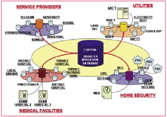
In recent past , humanity has suffered an increasing number of natural disasters affecting more than 2.5billion people, killing 478,100 and causing economic losses of about US$690bn (UNEP/ GRID-Arendal, 2005). Some of the distinctive instances are: December 2004 Indian Ocean earthquake and its concomitant tsunamis, The US eastern coast and Central America, hurricanes Katrina, Rita, Mitch, Stan and Wilma in September-October 2005, Pakistani earthquake of 2005, and now the current avian influenza in Asia and Europe. Natural and manmade tragedies, such as earthquakes, foods, nuclear catastrophes, pose an ever-present challenge to emergency services. Victims and societies at large have responded differently in each case. Some were heroic, some responsible but many panicked and responded irrationally. This aggravated the already bad situation. All of them could have responded more effectively if they were better informed and aright managed.

China cracks down on illegal surveying, mapping
China continues cracking down on illegal surveying and mapping and investigate and punish leaks of state secrets, said an of?cial from the State Bureau of Survey and Mapping (SBSM). Seven government departments including SBSM, Ministry of Information Industry and National Administration for Protection of State Secrets have pledged to strengthen control of the geographical information market. A total of 759 cases of illegal surveying and mapping were found in 2006, and many of the cases involved foreign organizations and individuals. Last year, two Japanese scholars were ?ned a total of 80,000 yuan and deported for mapping the coordinates of an airport and water facilities in Xinjiang Uygur Autonomous Region. It was feared their results could be used for military purposes.

US expresses concern over satellite-killing test by China
The USA, Australia and Canada have voiced concerns to China over the fi rst known satellite-killing test in space in more than 20 years. The capability demonstrated by China was no surprise to the Bush administration, which revised U.S. national space policy in October to assert a right to deny space access to anyone hostile to US Interests. The US has been researching satellitekillers of its own, experimenting with lasers on the ground that could disable, disrupt and destroy spacecraft. http://news.scotsman.com

NATO awards GIS contract to TENET
NATO NC3 Agency has awarded the GIS Data Preparation Contract to TENET supported by Galdos Systems Inc. and IIC Technologies Inc in Canada. The project involves the generation of a wide range of geospatial data models compliant with some of the latest spatial open information standards from OGC and ISO and the conversion of many terabytes of vector, raster and gridded data. A large proportion of NATO’s paper holdings of maps and charts will also be digitized and converted to the same set of open standards. The objective is to create an open and shareable map database as part of NATO core GIS infrastructure withinz the Alliance. At the forefront of these open standards are the two key encodings of GML and GMLJP2 to provide effective encoding for Raster and Coverage data.
www.galdosinc.com

In India, for topographical mapping, we are using an old Geodetic Datum (reference ellipsoid on which the coordinates: Latitude and Longitude are projected, and mapping is carried out), called Everest 1880, defined by the work of Col. George Everest (one of the greatest Geodesists, for whom the highest peak in the world is named). It is a local datum, best-fi tting for India (as in 1880), but not fi tting the Earth as a whole in the best possible manner.

The U.S. National Space Policy (NSP) was authorised by President Bush on August 31, 2006. This NSP establishes an overarching national policy that governs the conduct of U.S. space activities and supersedes the 1996 NSP.
The unclassified ten-page summary of the NSP consists of 13 self-contained sections including the principles, goals, guidelines (both general and specific to national security space, civil space and commercial space), international space cooperation, space nuclear power, radio frequency spectrum, orbital debris, effective export policies and space-related security classification.

£2 million printing press for paper maps
Ordnance Survey Director General and Chief Executive Vanessa Lawrence officially pushed the on button of a massive new £2 million printing press at the mapping agency’s Southampton head office recently. The six-colour printing press is one of the largest in the country and will be used to produce Ordnance Survey’s paper maps, including the 650 different recreational and leisure maps that together cover every corner of Britain. www.OrdnanceSurvey.co.uk

I am delighted to participate in the 26th Congress of the Indian National Cartographic Association (INCA). My greetings to the organizers, delegates of the Conference, cartographers, scientists and technologists, users of cartographic products and distinguished guests.
India has a vision of transforming itself into a developed nation before 2020. There are number of missions which need inputs from cartography technologies that will certainly accelerate the process of development. The programme such as Bharat Nirman Programme including PURA (Providing Urban Amenities in Rural Areas), networking of rivers, infrastructure development in 63 cities through Jawaharlal Nehru Urban Renewable Mission, mapping of earthquake prone areas and recurring floods in north Bihar and Assam require vital inputs at the stage of planning and implementation level. The mission of INCA should be to assist the implementation of developed India vision using their core competence in cartography in partnership with ISRO, NRSA, Survey of India, State Remote Sensing centers, Thematic map making organizations, Indian Remote Sensing Industries, Academia, Research Institutions and other IT organizations. Hence, I would like to talk to you on the topic “Cartographers: Partners in National Development”. Let us now look at some typical requirements of rural and urban development programmes of the nation, where cartographers are major partners.

Universal lessons have emerged from Australian local governments using GIS for more than 25 years. This commonality of GIS experience rises above the significant variations in functions, statues, geographical coverage and population densities in Australian local government. These lessons are relevant to the skill development, data access, technology integration, and functional integration of GIS to any organisation managing the assorted demands upon a region, or locality.


 (5.00 out of 5)