Articles in the Articles Category

The fourteenth meeting of the International Committee on Global Navigation Satellite Systems (ICG) was held in Bengaluru, India, from 9 to 13 December 2019 to continue…

“All of my life I’ve spent trying to learn how to produce living structure in the world. That means towns, streets, buildings, rooms, gardens, places which are themselves living or alive…

“All of my life I’ve spent trying to learn how to produce living structure in the world. That means towns, streets, buildings, rooms, gardens, places which are themselves living or alive…

Novel Scare
COVID-19 has spread
All across the globe, almost.
With over 4000 death counts
And over 1,27,000 infected,
Countries struggle to contain it.
The World Health Organization declares it a pandemic.
This is unprecedented.
Along with the health crisis, the world economy is in a quandary.
A time for self-isolation, if needed
But to collaborate and support each other, surely.
A global crisis looms large.
Humankind …
March 2020
Geo Week
March 23-25, Washington, DC
www.geoweek.com, www.lidarmap.org
HxGN LIVE India
24-25 March 2020 Delhi, India
https://hxgnliveindia.com
April 2020
United Nations/Mongolia Workshop
on the Applications of GNSS
13 – 17 April
Ulaanbaatar, Mongolia
www.www.unoosa.org
SpaceTimeAI 2020
20 – 22 April London, UK
www.ucl.ac.uk/civil-environmentalgeomatic-engineering/
May 2020
China Satellite Navigation Conference
May 2020
Chengdu, China
www.beidou.org
XPONENTIAL 2020
4 – 7 May
Boston, USA
www.xponential.org
GISTAM 2020
7-9 May Prague, Czech Republic
www.gistam.org
FIG Working Week 2020
10 -14 May Amsterdam, the Netherlands
www.fig.net
European Navigation …

What is the relevance and importance of this workshop?
Today, geospatial technology extends into virtually all areas of human activity….
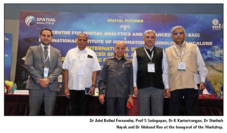
“India has been at the forefront at some unique systems like NRDMS, NRIS, NSDI, National GIS, etc.” said Dr K Kasturirangan, Former Chairman ISRO…

Today, information is key to the success of a citizen, society, governments and humanity as a whole. Our government’s vision is…

Global Navigation Satellite System (GNSS) is one of the best finding of the twenty century world technologies…

The Ministry of Housing and Urban Affairs (MoHUA) is engaged in the development and promotion of State-of- Art Technologies…


 (5.00 out of 5)