Articles in the Articles Category


he Japanese Quasi-Zenith Satellite System (QZSS) represents an innovative multi-service satellite system able to provide positioning for mobile users over Eastern Asia and Australasia. The integration of the QZSS with the present GPS and the European GALILEO will improve accuracy, availability and capability over a wide area. Throughout a collaborative research program, the space technology group of AIST, Japan and the University of NSW…

Christian Knoll, Trimble Navigation India Pvt Ltd on …
Indonesian military plane to map quake-hit areas
The Indonesian Defence Forces (TNI) have assigned a CN-235 airplane to carry out aerial photography on areas in the Yogyakarta region affected by 27 May 5.9-magnitude earthquake. The activity is aimed at making a detailed map of areas devastated by the quake.
TNI had also sent a Hercules C-130 plane carrying a TNI field medical team and three helicopters to evacuate victims. http://news.xinhuanet.com
june 2006
International Conference in GIS and Health
27-29 June, Hong Kong
chankw1@hkuoc.hk
http;//geog.hku.hk/HealthGIS2006
July 2006
ISPRS …
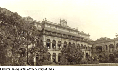
George Everest entered the Bengal Artillery as a Lieutenant on 4 April 1806 before he had even reached his 16th birthday. This rapid promotion was due to the number of vacancies at that time. Little has come to light about the first few years of his service in India until the siege of Kalinjar near Allahabad in 1812…
Conquering a technology is always important.
Owning it adds an arsenal to the might of the nation.
Hence, there is a …

Limestone constitutes the predominant raw material for manufacturing clinker, which in turn is an intermediate product to produce cement. But if the deposit is not homogenous and the coeffi cient of variation (COV) of the main inherent radicals in limestone is very high then the consistency in the quality parameters of the product varies and so on the process requirements thereby affecting productivity. In such cases the deposit has to be understood statistically and a proper geological model should be designed to best fi t our mine design parameters. This paper deals in detail how surpac leads in solving a similar problem…

SIRGAS (Sistema de Referencia Geocéntrico para las Américas) is a joint project of South, Central and North American countries in cooperation with some international institutions for the establishment and maintenance of a geocentric reference frame for practical and scientific use. A unique reference frame for the American continent was established by two extremely successful geodetic observation campaigns…

Rural development may be defined as structural changes in the socio-economic situation to achieve improved living standard of low-income population residing in rural areas and making the process of their development self sustained. It includes economic development with close integration among various sections and sectors; and economic growth specifically directed to the rural poor. In fact, it requires area based development…

In the 1970s, the US Department of Defense began GPS development as a military force enhancer. In 1983, President Reagan offered GPS civil services to the world, free of direct charges, as a result of the KAL007 disaster. This global offer sparked widespread civil use of GPS and significant investment in civil GPS technologies, to include GPS civil augmenting satellites (e.g. US Wide Area Augmentation System (WAAS), European…


 (5.00 out of 5)