Articles in the Articles Category

May 2007
International Conference on Integrated Navigation System
28-30 May, Saint Petersburg,
Russia elprib-onti@telros.net
Geoinformation for Disaster Management (Gi4DM2007)
23-25 May, Toronto, Canada
junli@ryerson.ca
5th International Symposium on Mobile Mapping Technology
28-31 May, Padova, Italy
naser@geomatics.ucalgary.ca
June 2007
Navigation Europe 2007
6-7 June 2007 in Amsterdam.
www.telematicsupdate.com/naveurope2007/
21st Pacific Science Congress
12-16 June, Okinawa, Japan
psc21@to.jim.u-ryukyu.ac.jp.
Spatial Data Quality 2007 5th International Symposium
13-15 June, ITC, Enschede,
The Netherlands
issdq2007@itc.nl
27th …

Sunderban, one of the largest mangrove forests in the world, is located in the deltaic region of Ganga and Bramhaputra rivers in India and Bangladesh. The impact of biotic and abiotic factors on Sunderban is enormous (Rao, 1959), due to which the area has got reduced to nearly half during the past few centuries (Blasco, 1975; Naskar and Guha Bakshi, 1982; Naskar, 1985).
The mangrove-forested area of Sunderban (including portions in Bangladesh) was recorded to be 20,000 km2 by Clark (Annon., 1895), and 17,500 km2 by Prain in 1903. Grif?th (1982) reported that mangrove forests in the Sunderban covered over 4264 km2 and 4109 km2 respectively in India and Bangladesh during early eighties. The present area of Sunderban is 2081 km2 (Anon., 2001).
The debate is intense.
So are interests, and the clash of interests.
Conflicts are visible.
Equally visible is the cynicism displayed by some.
We could see all these forces at play in the Munich
Satellite Navigation Summit last month.
Still, there is a hope.
There is also a strong sense of conviction, commitment and confidence.
Galileo will happen.
It has to.
It is just a …

The onset of the 21st century marked the beginning of the Asia-Paci?c era. This is the region where most of the world’s growth and economic development will occur over the next twenty years. The new millennium also signaled the birth of the urban era. Half of the world’s population now lives in cities, and that number is growing rapidly. In fact, the rate of urbanization in the Asia/Paci?c is alarming. The region currently has a population of 3.5 billion people; with that number expect to grow to 5 billion within the next 20 years. Most of that growth will occur in Asia’s cities.
This rapid urbanization presents staggering challenges for the region’s city governments. Up until now, most cities have not developed in a sustainable way. Economic development, land use planning, urban infrastructure, sewers, potable water systems, solid waste handling, and transportation systems are all inadequate to meet current needs let alone the rapid growth that lie ahead.

although distribution mechanisms and types of products available may change
IMTA claims to be “the voice of the industry worldwide”. Please comment.
The IMTA was established over 25 …
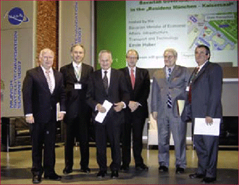
A review on one of the most famous european satnav symposia
The Munich Satellite Navigation Summit (MSNS) 2007 closed on March, 8th – about 400 guests from 28 nations left Munich after three days conferencing. In the run-up of the MSNS the conference advertised with the words: High quality, …
April 2007
63rd Annual Meeting, Featuring New Bio Navigation Workshops
April 23-25, 2007, Cambridge, MA
www.ion.org
2nd National GIS Symposium in Saudi Arabia
23-25April, 2007 Al-Khobar, Saudi Arabia
info@saudigis.org
http://www.saudigis.org/
May 2007
TimeNav’07 – ENC-GNSS 07
29 May – 1 June 2007
Geneva International Conference Center,Switzerland
Spatial Sciences Institute Biennial International Conference
14-18 May, Hobart, Tasmania, Australia
www.ssc2007.com
Intergraph 2007
21-24 May, Nashville, Tennessee, USA
http://www.intergraph2007.com
International Conference on Integrated …

Sustainability is the key issue in forest management, be it India, or any other part of the globe. Unfortunately, so far, no scientifi cally sound and operational defi nition of Sustainability has been evolved for universal application in forest management. Nevertheless, it may be said on an empirical basis that sustainable forest management lies in attaining three basic goals: fi rst, maintaining the stability of the physical environment, secondly, maintaining, and if necessary increasing, the biological productivity of the resource, and thirdly, establishing equity in distribution of qualitative and quantitative benefi ts generated by the resource in the society dependent on it. The goals are to be attained not at any chosen point of time, but in perpetuity. Sustainable forest management is a multidimensional process. The major dimensions of the process are: ecological, silvicultural, technical (including the disciplines of genetics and biotechnology), socio-economic, and institutional. All the dimensions are equally important and neglect of any can mar the Sustainability of the process.
There is news.
That too a good one.
Reportedly, all 4,800 maps of the Survey of India will be available in public domain.
As many as 2,900 are of open series.
It would happen by March end.
The commitment(!) comes from the Minister himself. The Minister of Science and Technology, Government of India.
It looks like actualization …

Second ESRI Asia-Pacific User Conference, 18-19 January, 2007, New Delhi, India
The Second ESRI Asia-Pacific User Conference under the theme of “GIS for economic development” was held at Hotel Taj Palace, New Delhi, India on January 18-19. Organized by ESRI India, the event witnessed participation from more than 900 …


 (5.00 out of 5)