| His Coordinates, Interviews | |
“FSI is well equipped with state of the art systems“
|
||||
What is the mandate of FSI?The broad mandate of the Forest Survey of India is to assess and monitor the forest resources of the country to provide reliable information on various parameter of the resources such as forest cover, its quality and the changes, volume of the growing stock of wood within forest and in trees outside forests, monitor success of plantation efforts etc. for state and national level planning.
FSI is celebrating 25th years of its existence. Would you like to highlight its three major achievements?
Please tell us the role of Geomatics in the activities of FSI?FSI has gradually progressed to adopt the geomatics as the basic science in the assessment of the forest resources, Digital image processing of the remote sensing data for classifying the forest cover and use of GPS for ground truthing and estimation of forest plantation areas has become quite popular. Operationalyzing of geomatics fully in all the activities of FSI is the only option to enhance accuracy and speed in assessing the forest resources. What is the status of geomatics capabilities in terms of infrastructure and trained manpower?Adoption of any new technology is a time taking process. Geomatics infrastructure has gradually grown in the organization and presently the FSI is well equipped with state of the art systems for carrying out RS, GIS & GPS applications. Through the regular programmes of skill upgradation, the technical personnel of the organization have been trained to use the new technology. Furthermore, trained young professionals in geomatics have also been engaged in various projects being implemented by the FSI. Do you have any programme for forest fire monitoring?FSI is using the rapid response system developed by Maryland University of USA in collaboration with NASA where MODIS satellite data has been used for detection forest fire in India on near real time basis during forest fire session (November to May). The State Forest Departments wherever the fire spots have been detected are informed on daily basis along with geographic coordinates and approximate location in the district. On analyzing the response of the State Forest Departments more than 90% of the forest fire incidence have been found to be correct. FSI is now proposing to assess the area of forest affected due to fire by analyzing the remote sensing data of the periods immediately followed by forest fire. What role do you see of FSI in NSDI?Forest cover data is in demand by Forest Department of the State and UTs and also by developments agencies like Irrigation Department, PWD, Railways, Rural Development and also by NGOs. On the other hand FSI uses data from Survey of India and NRSA. FSI is a partner to NSDI process, Operationalyzing of NSDI with meta data standards and application protocol will facilitate sharing of the data both by FSI and other stake holders. What is the status of forest in India in your perception?With the increasing population pressure and land hunger, India’s forests face a great challenge. Though at places forests get degraded but the stringent Forest Conservation Act supported the National Afforestation Programme has helped in maintaining and improving the forest and tree cover of the country. The preacher co-active role played by the environmentalists and NGOs also needs to be appreciated. What steps you envisage for forest conservations?Most of the States/UTs Forest Departments are following JFM formula. It is important that JFM areas are monitored periodically to know the impact of JFM on the development of forest resources and biodiversity besides its impact on socio-economic conditions of the participating village community. In addition strengthening front line field staff who are responsible for conservation/protection is extremely important as over the years the number is going down due to sluggishness in the recruitment.
|
||||
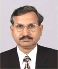 Dr. D Pandey, completed M.Sc in Statistics in 1971 from Allahabad University and joined the Indian Forest Service in 1975 and was allotted AGMUT cadre. Served in various capacities in the cadre and on central deputation as Faculty member of Forest Research Institute & Colleges. Completed Ph.D. (Forestry) from Swedish University of Agricultural sciences (Sweden) in 1996 with specialisation in ‘Forest Resources Assessment’.


 (No Ratings Yet)


