Articles in the Articles Category
The 7th International Navigational Symposium on Marine Navigation and …

LAND forms important part of development activity. Land revenue is one of the sources of income for state governments. It may come from land holdings by private individuals, real estate transactions or other natural resources being tapped by various sections of the society. Hence, creation of a Land Information Management System involves

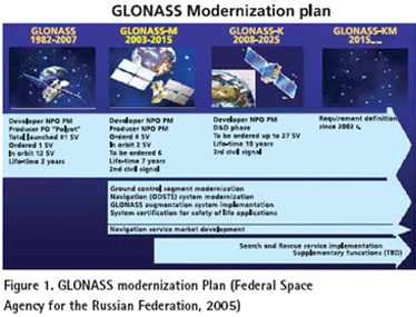
THE conventional geomatics industry including mapping and surveying applications has been revolutionized with the use of GPS, which is the best known, and currently fully operational satellite based navigation system operated by USA (Parkinson, and Spilker Jr., 1995). In the mean time, Russia also operates its own satellite based navigation system called GLONASS. The USA is modernizing GPS in order to retain its superiority in satellite based navigation technologies (MacDonald, 2002,). In order to keep up with USA’s progress in building next generation system, Russia is taking serious steps to modernize GLONASS as well (Federal Space Agency for the Russian Federation, 2005). The GPS and GLONASS signals are free but its availability is not guaranteed and currently most users are prepared to accept this risk (Parkinson, and Spilker Jr., 1995). However, as satellite navigation becomes a vital technology across a number of critical industrial sectors, the prospect of, for example, a nation’s transport infrastructure becoming dependent on this technology is a strategic risk that most industrial countries are not willing to accept. This argument initiated the Galileo program in Europe. Therefore, those systems form the mainframe of Global Navigation Satellite Systems (GNSS) (MacDonald, 2002,).
August 2007
GIS 14 Conference
14-15 August 2007
Vietnam
2nd Indonesian Geospatial Technology Exhibition
29 August – 1 September
Bakosurtanal; Jakarta
http://www.geospatial-exh.com/
September 2007
First International Summer School on Global Navigation Satellite Systems
Sep 02 – 09 2007
Berchtesgaden, Bavaria, …
We published a circular by Central Board of Excise and Customs, Government of India that came out in April (Coordinates, May 2007).
The circular classifies high technology featured mobile phone including GPS as a secondary feature as mobile phone.
That implies four per cent custom duty rather than 34 per cent as applicable to …

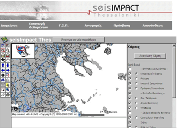
Greece has suffered many times from big earthquakes that caused human victims as well as big damage to public and private infrastructure. However, the 1978 earthquake in Thessaloniki (Mw = 6.5) motivated the beginning of a more systematic confrontation of the impact of such phenomena. This happened because it was the first time that a powerful earthquake affected a big modern city of roughly one million of residents. Thessaloniki presented the formal characteristics of Greek urban built environment: buildings with 4 to 8 storeys, large population in numbers and density, mixed land use, traffic problems and lack of effective planning of management of natural catastrophes. After the Thessaloniki earthquake, a situation of chaos was created due to the panic, the destructions, the lack of information and the innumerable calls on help, but also on control of static condition and damage of buildings. By that time, there was no specific procedure for the inspection of buildings and infrastructure. However, after the first period of embarrassment, the state agencies reacted. Inspection forms were designed, printed and distributed during the first days after the earthquake. The buildings were inspected by two-member teams of civil engineers in order to be classified in categories with regard to their damage and usability. These paper inspection forms constitute a valuable database concerning the impact of the earthquake to the buildings of Thessaloniki.


 (5.00 out of 5)