| His Coordinates, Interviews | |
Satellite navigation cannot solve everything
|
||||
Please tell us about the focus of research at your Institute.The Institute of Geodesy and Navigation of the University FAF Munich with presently more than 30 research associates from various disciplines (aeronautics, electronics, geodesy, informatics, technomathematics and physics) and various countries has three main research lines: Galileo and modernized and new GNSS, Receiver Development (mainly GNSS software receiver) and Sensor Fusion (integration of GNSS with other techniques like inertial, telecommunication, WLAN, etc.) Highlight for us the challenges that the research community should take up?There is no doubt that using GNSS for indoor positioning is a hot research item. We now have to come up with a new generation of Galileo and GNSS receivers which provide more capabilities for the user, perhaps through integration with other techniques, more robust, small and cheap to manufacture. Research communities come up when they recognize the huge commercial potential. You find now that every day so-called incubators are born. We are only at the beginning. What technological trends do you see in GNSS?The main trend I see is the integration of GNSS with other techniques. We know satellite navigation is a nice technique but cannot solve everything. We like to see seamless navigation in future, from outdoor to indoor, for an aircraft from gate to gate, for all applications – but that can only be achieved by integration with other sensors, data and techniques. Which are the key application areas emerging in GNSS?The recently published GALILEO Green Paper on Satellite Navigation Applications shows a variety of applications. By the end of this year we may have many mobile phones equipped with a GPS or GNSS chip. It is also true that we can hardly imagine how many applications we will have in the next decade – this is probably not so much constrained by technology but rather because of our limited imagination. Do you view Galileo as a complement to US GPS or competition?With the agreement between the EU and USA on 28 June 2004 (“Agreement on the promotion, provision and use of GALILEO and GPS satellite-based navigation systems and related applications”), a major milestone was reached for the worldwide user: to work with one simple receiver which is able to track both, GPS and Galileo. This means neither competition nor complementing GPS – it means cooperation of two global navigation satellite systems to get a significant redundancy in satellite observations for more availability, accuracy and integrity of many satellite navigation applications. The user will then not care in future whether he receives Galileo or GPS satellite observations. When do you foresee Galileo as a reality?We expect that a full Galileo system will be available from 2012 on. One of the present challenges is to solve the funding of the system: Can we realize Galileo as a so-called “public-private partnership” where governments and industry are investing in it, or do we have to consider Galileo as a modern infrastructure (like GPS) which governments provide to their citizens in the 21st century? The other challenge is to define in detail the Galileo Public Regulated Service, who are the users, and its applications. What are the measures to provide the necessary protection? There is no doubt that in Europe – now with 27 countries – it takes time to get consensus among all the member states. Do the regional initiatives of India and China complicate the scenario?First of all it is remarkable to see what kind of worldwide move in satellite navigation Europe has initiated ever since it started with the development of Galileo. It certainly shows a great impact of satellite navigation over the next few decades and a great potential in many applications affecting every citizen. However, given the fact that frequency resources are limited, it also means that all the big players have to sit at the table to solve the accommodation of the various signals in the frequency band. Moreover, trying to serve all users in the best way, we should start to coordinate the future “Global Navigation System of Systems”. What is your perspective on geodesy education?Satellite navigation is an interdisciplinary fi eld not yet covered properly by space sciences. That is also the reason that you fi nd only a few universities in Europe and worldwide covering it in more than just a single module in a certain lecture. We are therefore starting soon an Executive Master program on satellite navigation at our university for young engineers working already in the industry. We will also organize this year for students and young researchers between 02 to 10 Oct. 2007 the “First International Summer School on GNSS: A Worldwide Utility” in the Berchtesgaden area (south of Germany in the alps where the Galileo Test Environment, GATE, is starting its operation in April 2007) with international lecturers and in cooperation with Stanford University, Palo Alto, Ca. We also have many contacts in Asian and Australian universities and are trying continuously to improve these relations through exchange. Do you see any emergence of proper interface between industry and academia?There is no doubt that a close cooperation of universities with industry is necessary in satellite navigation. We are working with our institute that is always in consortia with the industry. I can only recommend that to all of my colleagues – it can be a win-win situation for both.
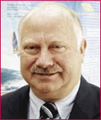
Prof Dr Günter W Hein is Director of Institute of Geodesy and Navigation at the University FAF, Munich. Prof. Hein´s main interest is the development of Galileo, Europe´s global navigation satellite system, where he serves as German delegate in the EC Galileo Signal Task Force. Prof. Hein received the 2002 Johannes Kepler Award for “sustained and signifi cant contributions to satellite navigation” from the US Institute of Navigation. |
||||


 (2 votes, average: 3.50 out of 5)


