


European Railway Traffic Management System (ERTMS) is the European standard for the Automatic Train Protection (ATP) and command and control systems. ERTMS is a safety system enforcing compliance from trains with speed restrictions and signalling status….
Volume XVII, Issue 3, March 2021
Using geomatics to fight the pandemic in Italy: A case study
Michail Elaiopoulos, Nella Vulcano, Norman Kevin Pisterzi, Alessandro Bianchi and Cristiana Patruno
Surveying1 education – Prospects and challenges post COVID-19
David Mitchell
What do the New Geospatial Guidelines have for Spatial Planners?
Mahavir and Prabh Bedi
Systematic Land Tilling using Open Source Geospatial Software and …
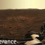
Another feat of human perseverance
When the Mars 2020 Perseverance Rover
Landed on the surface of Mars on Feb 18,2021
To look for habitability, seek biosignatures, cashing samples and
test oxygen production from the Martian atmosphere.
Equipped with new entry, descent, and landing (EDL) technologies, such as Terrain-Relative Navigation (TRN),
That allows the rover to …
Large-scale Deployment for Sonardyne Fetch AZA
A new breed of underwater sensor that is able to self-calibrate, enabling precise, long-duration subsidence monitoring at all depths, has been deployed at scale for the first time. The 20-plus Fetch Ambient- Zero-Ambient (AZA) pressure monitoring transponders (PMTs), developed by underwater technology specialist Sonardyne, will support an ongoing longterm, …
India notifies Unmanned Aircraft System Rules, 2021
The Indian Government on 14 March notified the Unmanned Aircraft System Rules, 2021. These rules will apply to Unmanned Aircraft System (UAS) registered in India, wherever they may be or possessing or engaged in exporting, importing manufacturing, trading, leasing, operating, transferring or maintaining an Unmanned Aircraft System in …
3,000+ Km Navigation-assisted autonomous driving expedition
XPeng Inc. has announced the launch of a long-distance navigation-assisted autonomous driving expedition from March 19 to 26, 2021, covering a total distance of 3,675 km across six provinces in China. The performance of XPeng’s newly released autonomous driving assistance function – Navigation Guided Pilot (NGP) – will be …
Free Resources to Protect Critical Infrastructure From GPS Spoofing
The Department of Homeland Security (DHS) Science and Technology Directorate (S&T) has published the Positioning, Navigation, and Timing (PNT) Integrity Library and Epsilon Algorithm Suite to protect against Global Navigation Satellite System (GNSS) spoofing, or deceiving a Global Positioning System (GPS) device through false signals. These …
TCarta awarded NOAA grant
TCarta Marine has been awarded a Small Business Innovation Research (SBIR) Phase II grant from the National Oceanic and Atmospheric Administration (NOAA). The research focuses on enhancing Satellite Derived Bathymetry technology for application in the coastal waters of Alaska.
Satellite Derived Bathymetry (SDB) extracts water depth measurements from multispectral satellite imagery …
18th century fort brought to Life with LiDAR and 3D Modeling
A Canadian archaeologist has used advanced mapping and visualization technologies to bring one of the earliest European settlements in North America back to life. Dr. Jonathan Fowler combined a centuries-old map with a modern 3D terrain model to portray Fort Anne and its surrounding …

James van Rens
Strategic Advisor RIEGL Group / Government & Industry Relations.
In the present challenging times, how has RIEGL adapted itself and have also come out with technology solutions for its customers especially ‘operating remotely’?
RIEGL is committed to ensure our customers’ needs are met. While our company as a whole has adapted to what is now …


 (5.00 out of 5)