Nearmap and DroneShield join forces
DroneShield Limited has announced an enhanced version of its DroneSentry- C2TMCommand-and-Control software, in partnership with location intelligence firm, Nearmap. It provides an intuitive and feature-rich software platform, providing counter-UAS awareness and reporting capability. It integrates both DroneShield and third-party C-UAS sensors and effectors. Those include multiple AIenabled sensing and tracking …
Advance autonomous vehicle scaled production program
Perrone Robotics, Inc. and Roush Industries has completed the first phase of a successful TONY® – AV, fully autonomous, zero-emissions, electric shuttle integration. The new prototype will be the model for a large-volume production process that will allow Perrone’s TONY AV-Retrofit kit to be easily integrated into existing vehicle …
PAR Government rebrands situational awareness solution
PAR Government, a provider of geospatial and decision support solutions for 57 years, has rebranded its TeamConnect™ cloud-based situational awareness suite as Sit(x)™. The commercial Sit(x) solution is designed for enhanced collaboration among government and civilian public safety organizations. PAR Government Systems Corporation (PGSC) is a wholly owned subsidiary …

First high-orbit GLONASS satellite in 2028
Russia plans to launch the first of the six high-orbit GLONASS satellites into orbit in 2028, according to the head of the GLONASS Application Division in the Russian space agency Roscosmos, Ivan Revnivykh. Such satellites will be able to transmit two navigational signals with code division in the L1 …

No, India’s forest cover has not increased steadily. Instead, tea estates, coconut plantations, and even tree-lined avenues are being classified as forests
M D Madhusudan
Ecologist
T R Shankar Raman
Ecologist
It is not long after dawn, but the air in the Borajan rainforest in upper Assam is already warm and heavy with humidity. On a fig tree by the …

Readers may recall that we have published the first part of this paper in April 2022 issue of Coordinates where material and methods were discussed. Here we present the concluding part
MD Abdul Mueed Choudhury
Department of Agricultural, Food, and Environmental Sciences, Marche Polytechnic University, 60131 Ancona, Italy
Ernesto Marcheggiani
Department of Agricultural, Food, and Environmental Sciences, Marche Polytechnic …

This paper evaluated a real-time KSACORS-based NRTK GNSS-INS integrated solution and a post-processed KSACORS-based NPPK GNSS-INS integrated solution
Mohammed El-Diasty
PhD, P. Eng. Civil and Architectural Engineering Department, College of Engineering, Sultan Qaboos University, Muscat, Oman
Abstract
Multibeam echosounding technique is used to provide sea-floor mapping with relatively high-quality level and requires an accurate positioning and attitude system. Integration …

Gravity inversion is a useful tool for determining Moho depths in regions without having adequate seismic information
Dr H M I Prasanna
Senior Lecturer, Faculty of Geomatics, Sabaragamuwa University of Sri Lanka, Belihuloya, Sri Lanka
Composite of the Earth’s Crust and Moho Estimation
Generally, the Earth is comprised three main internal structures: crust, mantle and core. These structures …

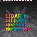
Volume XVIII, Issue 4, April 2022
LiDAR in oil palm disease detection
Nur Azuan bin Husin and Siti Khairunniza Bejo
Spatial and economic inequities and trends in South Africa
Sue Bannister, Michael Sutcliffe and Willy Govender
Mapping the urban atmospheric carbon stock
MD Abdul Mueed Choudhury, Ernesto Marcheggiani, Andrea Galli, Giuseppe Modica and Ben Somers
My Coordinates
EDITORIAL
News
INDUSTRY | GNSS | GIS …

Extreme climate events and many conflicts
Cause the upward trend in hunger
Even before the pandemic.
And as the pandemic was not enough,
The war has added to the miseries.
High energy prices, high fertilizers prices,
Disruption in supply chain and trades,
All lead to elevated inflation in food prices,
That is further worsened by the reduced income.
Many more millions are slipped into …


 (5.00 out of 5)