

The system presented in the paper is designed according to the scheme of compensation and processes navigation data with use of a Complementary Extended Kalman Filter (CEKF). The INS/TACAN/ALT system works with a feed-forward correction, i.e. there is no feedback to INS and its errors are corrected externally. The structure of system is shown in the Fig. 1…

The LBS market has been segmented into 3 main categories: • B2C: Business to Consumer • B2B2C: Business to Business to Consumer • B2B: Business to Business Details of this segmentation are provided in Figure 2. This segmentation highlights the diversity of services that can be offered by an operator. This diversity of services is also a diversity of business model. The LBS market has been especially Figure 1…

For reasons unknown, the “GIS/Geographic” has quietly crossed its rightful “domain
It was up to 1985 that everything …
The Ministry of Science & Technology, Government of India and Bentley Systems, Incorporated has launched the 2008-2009 Future Cities India 2020 competition finals. Currently in its third year, the competition encourages students to help prepare India’s cities for the year 2020 by providing design solutions to real-world infrastructure challenges. This …

ESRI’s International User Conference draws more than 14,500 attendees
ESRI President Jack Dangermond
In his opening remarks at ESRI’s 28th …
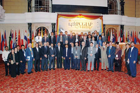
19-20 August 2008 – Kuala Lumpur, Malaysia
TThe UN sponsored Permanent Committee on GIS Infrastructure
(PCGIAP) together with …
From the role of land administration in sustainable development…
To the promotion of effective land markets.
e-land administration, land registration, cadastral surveying and mapping.
Poverty reduction and protection of vulnerable groups.
A range of issues.
The 14th PCIGIAP meet at Kuala Lumpur discussed and deliberated all.
Another step in a long journey…
The journey which is difficult and tortuous.
Understandably, when one deals …
SLA and MapKing launch free mobile StreetMap
Singapore Land Authority and MapKing (Singapore) Pte Ltd have jointly launched StreetMap@Singapore. It can be viewed on PDAs, PDA phones, and smart phones. Named as `SLA StreetMap Mobile’ it can be downloaded for free onto any mobile device running on Windows Mobile Operating System.
SLA StreetMap Mobile has similar functions with its online StreetMap@ Singapore at www.map.gov.sg. Anyone with a compatible mobile device can search for location maps using address, road name, postal code, building or development name on the move. Containing about 2,000 buildings, 4,200 named roads, and some 120,000 updated address points, it is driven by the MapKing engine. www.sla.gov.sg

Mobile tools for wayfinding combined with Location Based Services (LBS) can provide pedestrians with practical information concerning optimal routes and useful facilities in their vicinity. However, what is considered as “optimal” and “useful” largely varies between different kinds of individuals. Inappropriate information may hinder effective information extraction for a person seeking specific navigational and environmental information…

Survey and GIS: Finding the missing links Gary A Jeffress, Bruce Carlson, Gary R Kent, Matthew Smith, TN Wong
Galileo E5 signal acquisition strategies Nagaraj C Shivaramaiah, Andrew G Dempster
The way we walk
Alexandra Millonig
Fuzzy logic approach for sustainable land use planning
Novaline Jacob and Krishnan R


 (5.00 out of 5)