

Rohde & Schwarz recently demonstrated an ERA-GLONASS test setup consisting of the R&S CMW500 wideband radio communication tester…
A mapping tool that gives a detailed picture of local information in almost every corner of Great Britain has been released by Ordnance Survey (OS).
Recently, a new GPS satellite was launched to benefit U.S. military operations and civilian society as a whole. The new satellite will be checked out and enter service in a month’s time…
A Satellite Data Analysis and Application Centre (SDAAC) will be established on the premises of Acharya Nagarjuna University in India. ANU has signed an MoU…
With the launch of Galileo 7 and 8, the EU’s Galileo satellite navigation system now has a total eight satellites in orbit. Galileo 7 & 8 lifted off at 21:46 GMT on March 27 from Europe’s Spaceport in French Guiana on top of a Soyuz rocket.
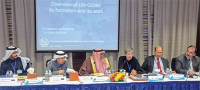
The inaugural meeting of the United Nations Committee of Experts on Global Geospatial Information Management Regional Committee for Arab States has been held in Riyadh, Saudi Arabia. Organised by the Secretariat of UNGGIM, in partnership with the Government of Saudi Arabia represented

Himachal Pradesh has been experiencing massive growth in hydel electricity projects during the last two decades or so. It was mainly on account of successive state government’s policy and emphasis on harnessing the hydel power potential of the state. As Himachal Pradesh…

During the last ten years, the possibilities for data acquisition in geodesy have been rapidly improved. The devices have become cheaper, smaller and more accurate and, on the other hand, they are capable of gathering a large number of data within a very short time interval.


 (5.00 out of 5)