

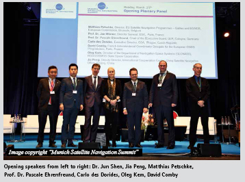
On March 25 – 27, 2019 the renowned conference “Munich Satellite Navigation Summit” welcomed about 450 participants at the Old Congress Hall in Munich, Germany. Within the last 16 years the Summit became an important event for getting updates on the latest news in GNSS as well as for high-level networking. As every year, the …

Navigation often relies on high accuracy and high-update rate global navigation satellite systems (GNSS) such as GPS, Galileo, Glonass, Beidu, Navstar…
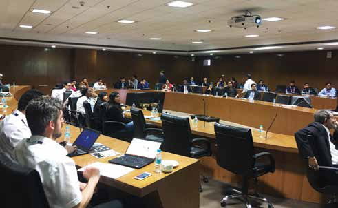
March 09, 2019, New Delhi, India
Global Navigation Satellite System (GNSS) forms an extremely important technological infrastructure having wide ranging applications catering to different strata of modern society. Different countries have invested heavily in building up the space segments of satellite constellations with a conservative estimate of more than $US400 billion presently available in terms of …

Unmanned aerial vehicle (UAV) is emerging to become a common tool in the geoscience field as it is usable across different field to cover a large-scale area with minimal cost…

Soil Moisture is a key component of water cycle budget [6]. It is fundamental measurement in the fields of hydrology, flooding, agriculture etc…

GNSS signals are quite vulnerable to interference, jamming and spoofing
Dinesh Manandhar
Associate Professor (Project) Center for Spatial Information Science (CSIS) The University of Tokyo, Japan
Today, when you buy a computer, you also buy an anti-virus software. But why? It’s because you don’t feel secure with virus attacks to your brand new computer and you would like …

Volume XV, Issue 4, April 2019
Zip
GNSS-CORS geodetic network development in Mongolia
Erdenezul Danzansan, Bayarsaikhan Enkhee and Togtokhbayar Sugir
Precise GNSS positioning for mass-market applications
Yang Gao
Egocentric leisure boat navigation in a smartphone based Augmented Reality application
Thomas Porathe and Jonas Ekskog
Surveyors in geo-data management
Hartmut Müller and Ulrike Klein
Automatic detection of
dead tree from UAV imagery
Seungmin Lee and Byeong-Hyeok
My Coordinates
EDITORIAL
Mark your …

When fake is in vogue
Not only in our physical world
But has percolated in cognitive arena as well.
Forces with vested agendas armed with powerful tools
Like facebook, WhatsApp, Twitter, etc.
Appears to have taken over our minds.
There have been reports that a few technical giants
Are said to have waged a war …
May 2019
5th International Conference on Geographical Information Systems Theory, Applications and Management
3-5 May 2019 Heraklion, Crete, Greece
www.www.gistam.org
13th Annual Baska GNSS Conference
5 – 8 May
Baska,Krk Island, Croatia
10th China Satellite Navigation Conference
22 – 25 May, Beijing, China
http://www.beidou.org
4th Joint International Symposium on
Deformation Monitoring and Analysis
15 – 17 May
Athens, Greece
http://jisdm2019.survey.ntua.gr
Geo Business 2019
21 – 22 May
London, UK
www.GeoBusinessShow.com
June 2019
International Conference on …


 (5.00 out of 5)