
NASA advancing GNSS capabilities
NASA is developing capabilities that will allow missions at high altitudes to take advantage of signals from Global Navigation Satellite System (GNSS) constellations — like GPS commonly used in the U.S. These signals — used on Earth for navigation and critical timing applications — could provide NASA’s Artemis missions to the Moon …

Modern cities and urban environments are becoming denser more heavily populated and are still rapidly growing, including new infrastructures, markets, banks, transportation, etc. In the last two decades, more and more cities and mega-cities have started using multi-camera networks in order to face this challenge.

This paper examines the spatial and temporal distribution of all COVID-19 cases from January to June 2020 against the underlying distribution of population in the United States. It is found that, as time passes, COVID-19 cases become a power law with cutoff, resembling the underlying spatial distribution of populations…
$400,000 grant for precision irrigation improvements
Viridix, an Israeli precision irrigation company, has received a $400,000 grant from the Israel Innovation Authority to enhance the remote sensing and AI capabilities of its RooTense® solution. This solution can increase crop yields by 20% while reducing water and fertilizer usage up to 50%. The Authority›s grant funds …
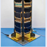
2020 – A record year for NovAtel GAJT GPS Anti-Jam Technology
NovAtel has announced that their GPS Anti-Jam Technology (GAJT) product lines achieved a milestone of more than several thousand units shipped worldwide in 2020. Despite COVID-19, 2020 has proven to be one of NovAtel’s most successful years in protecting PNT from Cyber Electromagnetic Activities (CEMA) …
NASA explores upper limits of Global Navigation Systems for Artemis
The Artemis generation of lunar explorers will establish a sustained human presence on the Moon, prospecting for resources, making revolutionary discoveries, and proving technologies key to future deep space exploration.
To support these ambitions, NASA navigation engineers from the Space Communications and Navigation (SCaN) program are developing …
The Autonomous Saildrone Surveyor Preps for Its Sea Voyage
The 72-foot-long vessel is launched recently into the bay from its dock at a former naval base in Alameda, California. It is designed to spend months at sea mapping the seafloor with powerful sonar devices, while simultaneously scanning the ocean surface for genetic material to identify …

The environment for seagrass to grow is in marine ecosystem. Providing habitat for marine biota is the seagrass’ primary role. Aside from that, seagrass is also able to absorb and store carbon, thus reducing CO2 in the atmosphere. Seagrass live best in a shallow marine water body and estuary. Seagrass ecosystem are located across the seacoast, with less than 5 meters depth.

The outbreak of the Covid-19 emerged from Wuhan, Hubei province of China, spread geo-spatially in more than 210 countries cau sing more than 25.416 million people of the global population infected and 0.851 million deaths (as on 30 August 2020), which is still exponentially spreading in geo-spatiotemporal way to the new geographical locations…

In the Virtual/ Augmented Reality computing world, a “Digital Twin” (DT)/ “Avatar” is used as a 3D graphical representation of either the user’s character/ persona, and movable machines or objects for very visually accurate representation for games and/ or virtual worlds.


 (5.00 out of 5)