
Articles in the Articles Category


Satellite Navigation service is an emerging satellite based system with commercial and strategic applications. To meet the user requirements of the positioning, navigation and timing…

When you think about it, GNSS is miraculous. Actually, like most magic, it is best for most people not to think too much about it. They just accept that today’s cars know…

This paper introduces a summary of the GEMNet system, and presents two sets of results. Firstly, characteristics of interferers observed operationally along with…

As the world’s diplomats
Grapple in Paris to clinch the climate deal
At United Nations Conference on Climate Change,
The 2nd International Symposium on Disaster Management was an invite-only event held over 3 days at the University of Melbourne which attracted over 130 attendees…
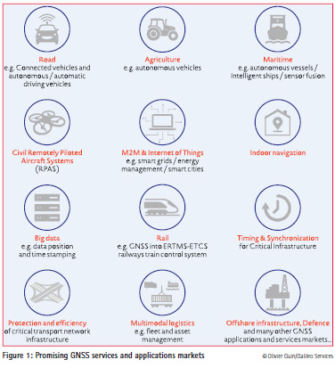
The GNSS downstream market continues to be one of the most promising markets in terms of European growth, with anannual growth rate of the global…

The territory of Bulgaria is one within the Balkan Peninsula region with active tectonics and seismotectonics. A number of geodynamical investigations try to give an…


 (5.00 out of 5)