Articles in the Articles Category


Mission Possible
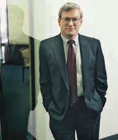
It is a seamless backup to GPS. {Paragraph} {Also please check there must be good enough line spacing}
It is cost-effective and completely interoperable.
Asserts The Independent Assessment Team (IAT).
Also, recommends unanimously to US Government.
To complete the eLoran upgrade and commit it as the national backup to GPS.
Two …

The GNSS Research and Application Centre of Excellence (GRACE), is a cross disciplinary centre providing cutting edge research, high calibre teaching, and business support services to the GNSS community. In October 2009 GRACE will move into its own state-of-the-art purpose built centre. A ground breaking ceremony took place on the 11th of November 2008, and construction of the centre is underway at the University of Nottingham Innovation Park (UNIP) on the Jubilee campus of the University of Nottingham.
It will be the only facility in UK dedicated to the development of downstream applications and services using GNSS. The European Union has estimated the market for downstream applications and services to be worth in excess of £230 billion by the year 2025. Supporting the University of Nottingham in this venture which will have an investment of £9.2m is the East Midlands Development Agency (EMDA), one of the nine regional development agencies in England. EMDA was established in 1999 with the primary goal to increase the economic growth of the East Midlands region.
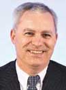
Says Steve Berglund, president and CEO of Trimble in an exclusive interview with Coordinates
Can you describe some defining …
April 2009
GEO Siberia 2009
21-23 April
Novosibirsk, Russian
nenash@sibfair.ru
http://www.geosiberia.sibfair.ru
Defence Geospatial Intelligence Middle East
26 – 29 April
Dubai
enquiry@iqpc.ae
http://www.geospatialdefence.com
May 2009
ENC-GNSS 2009 )
3-6 May
Naples, Italy
http://www.enc.gnss09.it
International Conference on Integrated Navigation Systems
25-27 May
Saint Petersburg, …

Because of the MEMS inertial sensors being more and cheaper, most studies focus on their applications. It is known that the simple principle and construction of the MEMS accelerometer make it is possible to improve the performance of MEMS accelerometers faster than that of gyros, so most efforts are done to use only the linear accelerometers forming the IMU called IMU-BA which has the potential market in the land and air navigation system, such as the car…

China claims a frequency for Compass.
Europe also wants the same for Galileo’s Public Regulated Service.
According to the International Telecommunications Union’s policies, the …
An interview with François Erceau, Vice President and General Manager, …

The effort for realizing fully autonomous and operative Unmanned Aerial Systems (UAS) induced the need of developing innovative techniques for integrating measurements derived from different aircraft navigation systems. Since no human aid is available onboard UAVs, navigation hardware must attain larger capabilities than the ones of manned platforms. In particular, the most important features that shall be considered are autonomy, safety,…

here has been a renewed interest in exploration of the moon and in the past four decades the exploration of moon has become a reality [1]. A number of missions have been flown to the moon by many countries. Many of these missions have carried imaging systems that, collectively, have returned an incredible wealth of information on the shape and surface characteristics of the moon. Mapping of moon began in the seventeenth Century by Galileo…

Oil was first commercially exploited in the North Sea in the 1960’s. Production is underpinned by regular and reliable helicopter operations enabling the movement of staff and equipment to and from the shore. However, the North Sea environment is challenging for rotorcraft operations from many perspectives, not least its remoteness from the shore, the exacting weather conditions and the changeable nature of rigs…


 (5.00 out of 5)