Articles in the Articles Category

says François Erceau vice president and general manager of Ashtech
While commenting on the name change from Magellan Professional to Ashtech you said, “Ashtech brings a remarkable legacy of technology, precision, and innovation, but the ‘new Ashtech’ is a venture for the 21st century.” Would you like to elaborate?
Founded in 1987, Ashtech® has long played an …
June 2010
GEA’2010
22 -24th June
Cracow, Poland
jacek@gea.com.pl
http://gea.com.pl/targieng.php
July 2010
ISPRS Centenary Celebrations
4 July
Vienna, Austria
www.isprs100vienna.org
ESRI International User Conference
12-16 July
San Diego, USA
www.esri.com
August 2010
Bengaluru Space Expo
25-28 August
Bangaluru, India
http://www.bsxindia.com
September 2010
ESA International Summer School on GNSS
1-11 September
Denmark
www.munich-satellite-navigation-summerschool.org/
IPIN 2010
September 15-17, 2010
ETH Zurich, Campus Science City
(Hoenggerberg), Switzerland
www.geometh.ethz.ch/ipin/
ION GNSS 2010
21 – 24 September
Portland, Oregon, USA
www.ion.org
G-Spatial Expo
19-21 September
Yokohana, Japan
g-expo@jsurvey.jp
www.g-expo.jp/en/
GDI APAC
28-30 September
kuala Lumpur, Malaysia
www.geopatialdefenceasia.com
International Astronautical Congress 2010
27 Sep – …

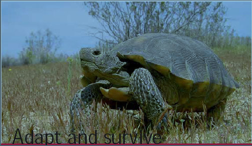
It is not the strongest,
Nor the most intelligent,
But the ones most responsive to change,
Survive.
So said Darwin.
With the advent of new species – Smart Phones, MIDs..
The landscape of satellite navigation industry is changing.
Once considered a powerful and promising navigation force,
The space of PND appears to be shrinking.
Probably there is a need to adapt.
And evolve.
Bal Krishna, Editor
bal@mycoordinates.org
Tweet

From the early days of the development of basic navigational software built into satellite navigational receivers, it has been noted that for the sake of simplicity and a number of other reasons, this navigational software is often based on methods of limited accuracy [1]. It is surprising that even nowadays the use of navigational software is still used in a loose manner, sometimes ignoring basic principles and adopting oversimplified…

During a disaster, situational awareness can mean the difference between life and death. Satellites provide reliable and rapid communication, observation and positioning tools, especially when crucial on-the-ground infrastructure is damaged. Risk management activities also benefit greatly from space-based data…

The development and deployment of the European Satellite Based Augmentation System EGNOS followed by the development of the Global Navigation Satellite System (GNSS) Galileo, that is currently under deployment, definitely represent the largest technological initiative promoted by the European Union so far. While designing and setting up its…
May 2010
International Conference on Integrated Navigation Systems
31 May – 02 June 2010
Saint Petersburg, Russia
http:/www.elektropribor.spb.ru
June 2010
Toulouse Space Show 2010
8 -11 June
Toulouse, France
Contact@toulousespaceshow.eu
www.toulousespaceshow.eu
Navigation and Location Summit Europe
15-16 June
Berlin, Germany
http://www.thewherebusiness.com/navigationeurope
IMTA Asia Pacific Conf. & Trade Show
18 -19 June
Melbourne, Australia
www.maptrade.org/events
GEA’2010
22 -24th June
Cracow, Poland
jacek@gea.com.pl
http://gea.com.pl/targieng.php
July 2010
ISPRS Centenary Celebrations
4 July
Vienna, Austria
www.isprs100vienna.org
ESRI International User Conference
12-16 July
San Diego, USA
www.esri.com
August 2010
Bengaluru Space Expo
25-28 August
Bangaluru, …

In the historical background section on the ISPRS site it says, “There is no clear-cut distinction between photogrammetry and remote sensing, and it is for this reason that the Society changed its name in 1980.” What then is the individual significance of ‘photogrammetry’ and ‘remote sensing’ for ISPRS?


 (5.00 out of 5)