| Applications | |
Lessons from Haiti
UN-SPIDER and SpaceAid support after the January 2010 earthquake in Haiti |
|
During a disaster, situational awareness can mean the difference between life and death. Satellites provide reliable and rapid communication, observation and positioning tools, especially when crucial on-the-ground infrastructure is damaged. Risk management activities also benefit greatly from space-based data.
In general terms, applying space-based technology to support disaster management in its various aspects means using suitable spectral ranges of electromagnetic radiation for observation and imaging, atmospheric sounding, radio communication, navigation and positioning, while taking advantage of the orbital position of satellites.
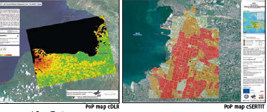
Images from Earth observing satellites are used to produce maps of disaster areas for overview information and damage assessment, and to provide specific data layers for applications of Geographic Information Systems (GIS), e.g. for early warning and risk and vulnerability mapping. Satellite communication serves to warn people at risk in remote areas, and to connect a disaster area to the outside world, providing medical information (telemedicine) or geographic information and data to support mapping activities. Global Navigation Satellite Systems (GNSS) provide positional information on disaster related events and objects and support relief teams in the field.
UN-SPIDER’s involvement in Haiti
First response
When the devastating earthquake of magnitude 7 struck Haiti on 12 January 2010, the UN-SPIDER SpaceAid framework was immediately activated and UN-SPIDER experts became involved in supporting the early response efforts less than 30 minutes after the earthquake hit. Together with UN colleagues from the UN Department of Field Support (Cartographic Section), from the Department of Peacekeeping Operations (DPKO), and others the situation in Haiti was assessed and the exact areas of interest as well as immediate needs were identified. It became obvious instantly that the massive damage to the local infrastructure made high-resolution satellite images and detailed satellite image-derived maps vital to assess the damage and plan the relief work on the ground.
Without delay, UN-SPIDER experts began to coordinate through their well established network with providers of space-based information, including public and private satellite operators, informed them of the most pressing needs and requested tasking of their satellites. Among others, UNOOSA requested the activation of the International Charter Space and Major Disasters on behalf of the United Nations Stabilization Mission in Haiti, MINUSTAH, and asked for mobilization of resources from the members of the Committee of Earth Observation Satellites (CEOS) on which UNOOSA through UN-SPIDER serves as vice-chair of the Working Group on Information Systems and Services (WGISS). Precious hours were saved because of these efforts. Eventually, post-disaster imagery was made available within less than 24 hours after the event.
In a second step, UN-SPIDER coordinated with several value adding providers to ensure that the available imagery could be used immediately to produce required services as for example maps to display accessible roads and suitable areas to set up relief facilities. UN-SPIDER also undertook great efforts to provide governmental and non-governmental agencies with the latest updates in order to facilitate coordination of their work. Direct support was provided for example to the UN Department of Field Support (Cartographic Section), the Office for the Coordination of Humanitarian Affairs (OCHA), the United Nations Population Fund (UNFPA), many NGOs (MapAction, DirectRelief etc.) and various international ad-hoc volunteer groups (CrisisMappers etc.) as well as universities. UN-SPIDER staff also closely coordinated with other UN agencies on the ground such as the World Food Programme (WFP), and with private entities like Google and ESRI. Throughout the entire response phase, UN-SPIDER maintained efficient two-way communication with a large number of emergency response teams, satellite operators, value adders and service providers across the UN-SPIDER network and facilitated coordination among them.
Gateway to information
UN-SPIDER’s main information dissemination channel to support international efforts in terms of space-based assets in response to disasters is the SpaceAid section of the Knowledge Portal. One special feature on the website is a satellite-tasking table where all available information about planned time and area of acquisitions from several satellites and sensors are published. This tool allows for self-coordination among satellite operators and image providers in order to avoid duplication; it also enables value adding organizations and relief teams to be informed about the latest available information. Once new imagery becomes accessible, links to browse images or download pages are provided as well. The published information on the page is continuously updated and distributed to end users in the field and the general public.
In the case of Haiti, UN-SPIDER has been compiling, organizing and disseminating the latest available space-based information, including web links to satellite-derived images, maps and related geospatial data of the affected areas on a dedicated SpaceAid website (link: www.un-spider.org/haiti). For the Haiti earthquake, the respective SpaceAid Updates webpage was consulted more than 4000 times by partner agencies, relief experts, scientists, the media as well as the public. Another major achievement in response to the Haiti earthquake is the establishment of a time critical Web Map Service (WMS) by UN-SPIDER. This service allows for serving geospatial data over the web and also for viewing data even over low-bandwidth connections, without the need to download and process the raw data. Within only two days of operation, about 1.5 million jpeg files were delivered through this service to intermediaries, value adders and other users. As an additional service to support relief operations, UN-SPIDER set up an ftp site on its servers in order to disseminate otherwise restricted raw data to eligible partners such as emergency relief organizations.
| What is UN-SPIDER?
The world of disaster management and space-based technologies is complex. Knowledge and expertise are widely dispersed. Institutions and practitioners need support, orientation and advice to access and use available data, information, knowledge and services. In recognition of these needs the United Nations General Assembly, in its resolution A/RES/61/110 of 14 December 2006, established UNSPIDER as a programme implemented by the United Nations Office for Outer Space Affairs (UNOOSA), with the following mission statement: “Ensure that all countries and international and regional organizations have access to and develop the capacity to use all types of space-based information to support the full disaster management cycle.” UN-SPIDER is achieving this by being a gateway to space-based information for disaster management support; serving as a bridge to interlink the disaster management and space communities; and being a facilitator of capacity-building and institutional strengthening |
Unfortunately, due to the disrupted infrastructure in Haiti, the huge amount of compiled data could not be downloaded by the partners on the ground via internet. Interrupted networks and low bandwidth pose a serious bottle neck, and this was also the case in Haiti. Feedback from users on the ground suggests that it was from difficult to impossible for them to download large files via internet for the first couple of weeks after the earthquake. Therefore, UN-SPIDER staff hand-delivered approximately 50 GB of digital elevation data as well as satellite and aerial imagery on a hard drive to cartographers from OCHA/ReliefWeb while conducting a Technical Advisory Mission in Santo Domingo, Dominican Republic.
Ensuring continuous support for recovery and reconstruction
After the conclusion of the first response phase, UN-SPIDER has not ceased its involvement but rather seeks to play a decisive role in supporting the ongoing recovery and reconstruction efforts. UNSPIDER submitted a project proposal for the UN Haiti Flash Appeal covering the topic of “Satellite derived geo-information to support relief efforts and early recovery”. With this project, UN-SPIDER envisages ensuring accessibility of all available geospatial data and derived products for Haiti by compiling and disseminating these to all beneficiaries, in particular to international organizations and the Civil Protection Agency of Haiti, through the UN-SPIDER Web Map Server as well as dedicated ftp sites. Also, UN-SPIDER will support the use of space-based information by local partner institutions to enable them to assess priority areas for further interventions. In particular, UNSPIDER seeks to strengthen the capacity of the Civil Protection Agency of Haiti to access and use the compiled geospatial data according to the country’s needs.
As another major follow-up to the early response phase, in its capacity as UNGIWG co-chair, UNOOSA through UN-SPIDER is coordinating an Ad hoc Haiti Geospatial Cooperation Task Group comprising UN Agencies, governmental and nongovernmental organizations as well as other partners in order to ensure better communication among the various agencies that provide geospatial support to Haiti and also to coordinate the work ahead. Among others, the establishment of a Spatial Data Infrastructure (SDI) for Haiti involving all partners will be one of the major tasks ahead to be coordinated. The group convenes by teleconference on a bi-weekly basis and uses various electronic communication tools, including a workspace on the UN-SPIDER Knowledge Portal, to facilitate its work.
On request of the government of Haiti, UN-SPIDER conducted a Technical Advisory Mission to Port-au-Prince from 14 to 20 March 2010. The purpose of the mission was to support the Civil Protection Agency of Haiti and the National Center for Geo-Spatial Information to rebuild their capacities to access and use space-based technology and information for disaster-risk management and emergency response. In view of the coming hurricane season, the mission team also tried to identify institutional partners who may be able to provide technical assistance, while capacities are re-established within government agencies dealing with geospatial information and disaster response. During the mission, UN-SPIDER managed to facilitate links between the relevant national agencies and GIS units of several UN agencies present in Haiti with respect to disaster management, and to facilitate technical assistance to these national agencies. UN-SPIDER was able to identify through this mission current strengths, impacts provoked by the earthquake as well as needs to rebuild local capacities. Based on the mission insights, UN-SPIDER will develop an action plan on how to best ensure continuous support to those agencies in the short and in the long term. UNSPIDER is committed to further providing long-term support to the Government of Haiti, especially in cooperation with the Civil Protection Agency and the National Center for Geo-Spatial Information and its partners from the international community.
Lessons from Haiti:
In disaster management in general and during the response phase in particular there are numerous challenges to face, especially in developing countries. Poor infrastructure and communication channels, lack of adequately trained personnel, and weak cooperation among institutions are some of the main hurdles to overcome. The destruction caused by disasters creates additional difficulties.
Communications
When a disaster strikes, land-based communications infrastructures are highly vulnerable and often fail due to destruction or saturation of the channels available for such communications. Satellite communications offer an alternative in these situations. They can be delivered to the users immediately after a disaster to facilitate communication and relief efforts. In the case of the earthquake in Haiti, the disrupted communication channels during the first hours after the incident did pose an obstacle in assessing the situation and the needs and in coordinating with the local partners. Satellite communications seem to be the only secure way to support specific emergency telecommunication needs. Ideally, they would facilitate the deployment and operation of on-the-scene teams and their sharing information internally as well as externally with other organizations; they could operate with wired and wireless media, and could be affordable and accessible to the entire spectrum of potential users. For emergency responders, satellite phones and derivatives are the most robust, reliable emergency communications means during the first response, search and rescue, and the recovery phase of a disaster. For communicating and relaying data, voice and video to the rest of the world and from the rest of the world to the area of the disaster VSAT (Very Small Aperture Terminals) is the technology of choice. VSAT and/or portable base towers for cell phones offer the best viable solutions for providing temporary means of communication to the affected population until the telecommunications infrastructure is restored.
UN-SPIDER is in the process of developing partnerships and networking with the space communications providers, namely telecom satellite operators, satellite phone companies, and satellite broadband providers, to help coordinate the provision of robust emergency communications means to the countries at the face of disasters. In this process, UN-SPIDER consults and takes into account similar work done by other organizations, such as the International Telecommunication Union (ITU) in order to avoid the duplication of efforts. To achieve this in the most effective and complimentary fashion UN-SPIDER will: determine the current emergency telecommunications capacity and capability of UN and UN-affiliated organizations, telecom satellite operators, and international and national aid agencies; make this information available to the community and to the general public through the UNSPIDER Knowledge Portal; and increase the awareness of these capacities by means of UN-SPIDER Technical Advisory Missions and relevant gatherings.
Infrastructure and institutional framework
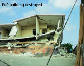
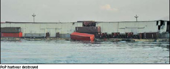
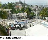
But not only communication difficulties are to be overcome. As was the case in Port au Prince, the facilities of the national Civil Protection Agency collapsed, the MINUSTAH mission was temporarily not able to respond due to severe losses in its own personnel, buildings, and materials, and other international relief organizations and NGOs already on the ground also experienced severe losses. The building which hosted the National Center for Geo-Spatial Information, which is the main national user of satellite imagery and maps, was also destroyed by the earthquake. This kind of disruption of the response mechanism indeed generates a major problem in assuring timely needs assessment. It was difficult to get the available information to the end users, namely the disaster management community on the ground. According to users from the Civil Protection Agency of Haiti, in the beginning of the crisis in Port au Prince it was not possible for them to access the UN-SPIDER portal. With a heavily affected local institutional setting it becomes even more difficult to efficiently manage the situation and provide adequate support fast.
| What is SpaceAid?
SpaceAid is UN-SPIDER’s framework to facilitate fast and efficient access to space-based information in case of disasters for countries, international and regional organizations. This includes all types of information provided by earth observation satellites, communication satellites and global navigation satellite systems. SpaceAid support can be accessed by the UN-SPIDER National Focal Points (NFP), UN-SPIDER Regional Support Offices (RSO) and UN organizations. Government agencies, major international and regional organizations will also have access to SpaceAid as procedures develop. Users can request the support through a hotline via telephone, e-mail or fax. A central coordination unit coordinates and follows-up on all requests. This framework is operational on a 24 hours a day/7 days a week basis in order to respond timely to a disaster. Through its SpaceAid Framework, UNOOSA continues to be the main contributor to ensuring access and use of space-based information to support emergency response, especially in developing countries. |
UN-SPIDER closing the gap
Strengthening national institutions and national response mechanisms is therefore part of UN-SPIDER’s mandate. User feedback underlines the need to develop and reinforce a national system for risk and disaster management and also to promote preventive measures. Furthermore, insufficient human resources in terms of qualified national experts to work with space-based information, or simply lack of awareness about the potential benefits of space-based information for disaster management can be a problem
UN-SPIDER tries to close these gaps with various means, one of them being Technical Advisory Missions that are being conducted to an increasing number of countries, including the one to Haiti in March 2010. During these missions, UN-SPIDER, together with experts from varying countries and institutions, visits national disaster management authorities and organizations involved in this topic in order to assess their capacities to access and use space-based information. These Technical Advisory Missions generate analyses with recommendations for followup actions, as well as recommendations for policies on disaster management issues and for strengthening capacity-building measures in the country. At the same time, raising awareness at the national level and during conferences and workshops, as well as providing support for capacity-building activities are part of UN-SPIDER’s main activities. The objective of these efforts is to ensure that countries recognize the value of all types of space-based information, and therefore will access it to reduce the impacts of disasters and to respond more efficiently in case of such disasters through improved use of this type of information. Furthermore, the SPIDER Global Thematic Partnership serves as a forum to facilitate networking among the global community of practitioners involved in space-based information and services to support disaster risk management. It was launched to facilitate access to space-based information for disaster reduction, in line with efforts conducted by ISDR, in particular to support national and regional platforms in their activities regarding disaster risk reduction. Last but not least, the Knowledge Portal provides a virtual platform for information sharing, communication, and process support. It offers orientation to all users and provides updates on the latest UNSPIDER activities. It is accessible at www.un-spider.org and you are cordially invited to visit and register as a user.
-UN-SPIDER Team
My Coordinates |
EDITORIAL |
|
His Coordinates |
Orhan Altan, President, ISPRS |
|
News |
INDUSTRY | GPS | GALILEO UPDATE | LBS | GIS | REMOTE SENSING |
|
Mark your calendar |
MAY 2010 TO NOVEMBER 2010 |


 (No Ratings Yet)


Leave your response!