
The ionosphere represents one of the most important error sources that affecting GPS positioning. It is strongly related to solar activity and geomagnetic ?eld. The GPS satellites and dual frequency receivers can be used to measure the Total Electron Content (TEC) of the Earth’s ionosphere. Global electron content maps have been produced by various research centers using the world-wide permanent network of GPS receivers. In this study a rapid method of monitoring the ionospheric disturbance using dual frequency GPS data of the Aristotle University Thessaloniki (AUT1) permanent station is presented. The Total Electron Content can be determined using the so called Single Layer Model (SLM) of the ionosphere. The SLM is based on the assumption that all free electrons are concentrated in a spherical layer of in?nitesimal thickness (single layer) at height H above the earth’s surface. The Total Electron Content is modeled as a truncated Taylor series with the geographical latitude and the hour angle of the sun as independent variables, using the L4 – geometry free linear combination. The results are con?rmed using global information for Sun spot and geomagnetic activity from NOAA and Kyoto University respectively.

The onset of the 21st century marked the beginning of the Asia-Paci?c era. This is the region where most of the world’s growth and economic development will occur over the next twenty years. The new millennium also signaled the birth of the urban era. Half of the world’s population now lives in cities, and that number is growing rapidly. In fact, the rate of urbanization in the Asia/Paci?c is alarming. The region currently has a population of 3.5 billion people; with that number expect to grow to 5 billion within the next 20 years. Most of that growth will occur in Asia’s cities.
This rapid urbanization presents staggering challenges for the region’s city governments. Up until now, most cities have not developed in a sustainable way. Economic development, land use planning, urban infrastructure, sewers, potable water systems, solid waste handling, and transportation systems are all inadequate to meet current needs let alone the rapid growth that lie ahead.

although distribution mechanisms and types of products available may change
IMTA claims to be “the voice of the industry worldwide”. Please comment.
The IMTA was established over 25 …
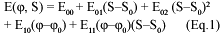
A review on one of the most famous european satnav symposia
The Munich Satellite Navigation Summit (MSNS) 2007 closed on March, 8th – about 400 guests from 28 nations left Munich after three days conferencing. In the run-up of the MSNS the conference advertised with the words: High quality, …
Galileo – the European Programme for Global Navigation Services for civil purposes is an initiative led by European Union. We provide regular updates to our readers on the Galileo programme.
China cracks down on illegal surveying, mapping
China continues cracking down on illegal surveying and mapping and investigate and punish leaks of state secrets, said an of?cial from the State Bureau of Survey and Mapping (SBSM). Seven government departments including SBSM, Ministry of Information Industry and National Administration for Protection of State Secrets have pledged to strengthen control of the geographical information market. A total of 759 cases of illegal surveying and mapping were found in 2006, and many of the cases involved foreign organizations and individuals. Last year, two Japanese scholars were ?ned a total of 80,000 yuan and deported for mapping the coordinates of an airport and water facilities in Xinjiang Uygur Autonomous Region. It was feared their results could be used for military purposes.
GIS ILWIS migrates to open source
The Integrated Land and Water Information System (ILWIS, http:// www.itc.nl/ilwis) is a PC-based GIS & Remote Sensing software, developed by ITC. The ITC directorate has recently decided to make current ILWIS software free of charge and to migrate it as such to open source software under the 52° North initiative. Leading research organizations in the ?eld of geoinformatics (ifgi, conterra, ITC, ESRI) participate in 52° North’s innovative development for establishing open spatial data infrastructures (SDI) and transformation of these into practical technological solutions.
Redefnition of Indian Geodetic datums – horizontal and vertical
BRIG (DR) B NAGARAJAN AND R K SAWHNEY
Building sustainable cities using enterprise GIS
MAYOR JEREMY HARRIS RET
TEC values estimation over a permanent GPS station
DR CHRISTOS PIKRIDAS AND MILTIADIS CHATZINIKOS
Mangrove habitat dynamics
S K SINGH
April 2007
63rd Annual Meeting, Featuring New Bio Navigation Workshops
April 23-25, 2007, Cambridge, MA
www.ion.org
2nd National GIS Symposium in Saudi Arabia
23-25April, 2007 Al-Khobar, Saudi Arabia
info@saudigis.org
http://www.saudigis.org/
May 2007
TimeNav’07 – ENC-GNSS 07
29 May – 1 June 2007
Geneva International Conference Center,Switzerland
Spatial Sciences Institute Biennial International Conference
14-18 May, Hobart, Tasmania, Australia
www.ssc2007.com
Intergraph 2007
21-24 May, Nashville, Tennessee, USA
http://www.intergraph2007.com
International Conference on Integrated …
Nokia N95 smartphone with GPS capabilities starts shipping
Nokia N95 has started shipping in key European, Asian and Middle Eastern markets. The phone is an all-in-one multimedia computer with a unique 2-way slide design, integrated GPS functionality and many other features. www.nokia.com


 (5.00 out of 5)