

Demands of GPS for ships in Philippine Philippine-based transport group United Transport Koalisyon has urged lawmakers to use GPS for all ships to reduce maritime accidents and also save fuel. It will also help coast guard in tracking down ships in distress. www.portworld.com Indian Dept of Post to install GPS in NE region To overcome the difficulties and challenges faced in smooth and timely movement of…
Haiti shocks sent reminders.
With around 2,00,000 dead and 3,00,00 injured.
About the nature’s might and fury.
We feel helpless again.
And look up to the government, systems, technology, experts, …
For assistance, actions, accountability and response.
Still, the questions remain.
Can disaster prediction be more than just guesswork?
Can disaster preparedness be more than just a term?
Can response to disasters be quick …
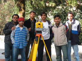
Survey Camp, Nainital was held from 28th November – 7th December, 2008 as part of the academic curriculum at IIT Kanpur. The site chosen for the camp was Nainital which is set in a valley containing a pear-shaped lake and is bounded by a great snowy range which forms the central axis of the Himalayas …
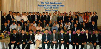
Showcase of New GNSS Era
The First Asia Oceania Regional Workshop
Jan 25-26, 2010, Bangkok, Thailand
The First Asia Oceania Regional Workshop was held on January 25 and 26 at Sofitel Centara Grand Bangkok, Thailand. The workshop was hosted by SPAC, JAXA and GISTDA as well as supported by United Nations International Committee on GNSS (UN ICG). The …
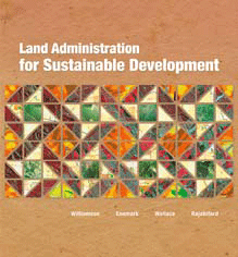
Land Administration for Sustainable Development examines global land administration systems at different levels of maturity. This examination elucidates how countries can establish basic infrastructure for the implementation of land-related policies and land management strategies that will help ensure social equality, economic growth, and environmental protection. Through its presentation of a holistic view of land management …
28th Jan 2010 – As many as 500 responders and relief workers in Haiti are now using GIS software
The intense public debate on how rapidly the Himalayan glaciers are retreating highlights the necessity for the constant monitoring of glaciers worldwide by satellites. Considering the valuable role satellites can play in determining the state of Earth’s glaciers, the Global Climate Observing System (GCOS) has called for the systematic monitoring of glaciers by satellites in …
NIIT GIS Ltd has entered into a strategic relationship with ITT Visual Information Solutions (ITT VIS). As part of this partnership, NIIT GIS Ltd. will become the exclusive distributors of the ENVI suite of image processing software products for India, Nepal, Bhutan and Sri Lanka Sri Lanka. This suite of ITT VIS products includes ENVI, …
VisionMap launched its stereoscopic mapping technology designed for integration with small tactical unmanned aerial vehicles. It has released its new lightweight MIST system for the rapidly growing small UAS market that provides security authorities with intelligence and reconnaissance mapping. According to VisionMap’s representative, the approximately 22 pound tactical UAV data collection system is designed to …
DMCii is using satellites to acquire new images of the Congo rainforests from space, validating a system that can map the vast Congo Basin every year to measure changes in its forest cover. If adopted, the new system will provide more accurate and up to date information for forest management, policy making and programmes such …


 (5.00 out of 5)