Realising the importance of Indian market, TomTom opened an expanded map making facility in Pune. Its new offices introduced state-of-the-art standards for delivering fresh, accurate navigation content and routing intelligence to India. The company delivers compelling new map products to the Indian consumer using multiple data sources including the latest crowd sourcing and community input tools.
The federal grid operator NIS GLONASS and German company Siemens have signed a memorandum on strategic partnership on creation in Russia the electronic system of charging tolls from cargo transport for damage, done to highways, innovation and venture news source UNOVA reports citing Siemens.

Norway intends to expand surveys of a previously disputed area in the Arctic offshore region bordering Russian waters ahead of potential oil exploration, Norway’s prime minister. The country’s seismic survey program began last summer in the boundary waters of the Barents Sea and will now move north, to an area east of the Svalbard archipelego, Prime Minister Jens Stoltenberg said. The more northerly part of the survey program will start this summer and continue into 2013.
Blue Marble Geographics has announced the release of GeoCore 2012, the all-in-one data conversion developer toolkit for geospatial data. The updated version of GeoCore features GeoCalc 6.5, GeoTransform 6.2, and GeoTranslate 5.2. If desired, the latest versions of these software development kits are also available for individual purchase. When combined into GeoCore users can seamlessly work with any Blue Marble data conversion toolkit in the same development environment to build powerful geospatial software.
European Commission Vice President Antonio Tajani has announced that the consortium led by OHB System AG and Surrey Satellite Technology Ltd (SSTL) will build a further eight satellites for the European Union’s Galileo satellite navigation programme under the supervision of the European Space Agency.

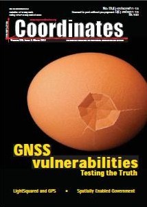
GNSS vulnerabilities: Testing the Truth: Dr C S Dixon, Dr C J Hill, Dr M Dumville, Dr D Lowe;
The realization of [the] geocentric datum for Brunei Darussalam 2009: Dr Kazimierz Becek, Dr Adam Lyszkowicz;
Too Fast, Too Furious Was Haste: Gavin Schrock;
Cloud services are transforming the remote sensing industry: Brian Rohde;

Despite the good performance of GPS, there are more than a few GNSS vulnerabilities and threats. Categorisation into unintentional and intentional is sometimes done to aid understanding. Unintentional disruptions include natural phenomena such as high levels of ionospheric disturbance and solar flares, as well as man-made phenomena including system errors (satellite or signal), and unwanted radio frequency transmissions (TV, microwave communications, radar, …).

Replacing the horizontal datum of a country is a complicated and difficult project. The decision to embark on such a “revolutionary” move should only be taken after in-depth studies to identify compelling reasons for such replacement. Here, we comment on the article by Tahir et al. published in the September 2011 issue of Coordinates.

Innovation and progress are essential, and an imperative, but only if bourn of responsible actions. A recent battle between two of the pillars of innovation and progress; satellite-based positioning, and wireless communications represent such high stakes that some have been driven to advocate for irresponsible actions to support or rationalize their respective positions.


 (5.00 out of 5)