Droneshield join hands with Thales
DroneShield has entered into a Teaming Agreement with Thales Programas De Electronica Y Comunicaciones S.A.U. (“Thales”) (a Spanish subsidiary of Thales S.A.), whereby Thales will utilise and promote DroneShield’s products in its defence and security contract bids in Spain involving counterdrone aspects.
Drones help map sea level rise
Drones can be used to …
Actifio teams up with Onix
Actifio, enterprise Data-as-a-Service (DaaS) software provider, has announced an alliance with Onix, provider of cloud computing solutions and consulting services. This alliance will provide Onix customers with a powerful cloud infrastructure backed by data replication and disaster recovery services powered by Actifio, allowing enterprises to bring their on-premise environment to the …

Volume XIV, Issue 12, December 2018
Zip
From oral agreement to distributed agreement: digital ledgers in land registration
Mohsen Kalantari, Xueling Chen, Zhouyang Wang, Luan Nguyen
Geo-Information tools, governance, and wicked policy problems
Yola Georgiadou, Diana Reckien
CORS usage for GPS survey in Greater Accra region: Advantages, limitation and suggested remedies
Surv. Sebastian Botsyo (MGhIS), Bernard BORKETEY BORTEI, John AYER
Spatial heterogeneity, scale, …

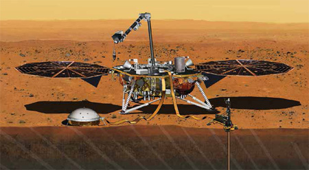
InSight lander
On 26 November 2018
Humanity achieved another milestone
When InSight lander successfully landed on Mars.
Launched on 5th May 2018
It not only intends to study the deep interiors of the Mars
And evolutionary processes
but also the possible seismic activity there.
However, the mission gets an unexpected breakthrough
When it is said to have recorded the sounds of wind
On 1 December …
January 2019
TUSEXPO 2019
16-18 Jan
Rotterdam, the Netherlands
https://tusexpo.com
GeoInsurance Europe 2019
22-23 January London, UK
https://geo-ins-eu.coriniumintelligence.com
Cognizant Autonomous Systems for Safety Critical Applications (CASSCA) 2019
28-29 January
Reston, VA USA
www.ion.org
International LiDAR Mapping Forum (ILMF)
28 – 30 January
Denver, United States
www.lidarmap.org
International Technical Meeting (ITM)/
Precise Time and Time Interval Systems and Applications (PTTI) 2019
28-31 January
Reston, VA USA
www.ion.org
March 2019
2019 URSI Asia Pacific Radio Science Conference
9 – 15 …
LabSat 3 Wideband is an RF signal record and replay system with three independently tuneable wideband channels…


 (5.00 out of 5)