Bell and Esri Canada deliver Integrated Smart City Ecosystem
Bell and Esri will create the Bell Integrated Smart City Ecosystem. This integrated solution will combine Bell’s award-winning 5G network and Internet of Things (IoT) solutions with Esri’s realtime analytics and location intelligence capabilities to help cities of all sizes across Canada become connected communities.
The Bell Integrated …
NovAtel enhances the performance of the GAJT-710
NovAtel have announced an update to their GPS Anti-Jam Technology (GAJT) portfolio. As the leading provider of assured positioning, navigation and timing (APNT) products, it has introduced the new GAJT-710 product line that features several enhancements over the previous generation. The GAJT-710 product line is the next evolution of …
IFEN GmbH appoints V3 Novus its distributor for India
iFEN Gmbh, Germany have appointed V3 Novus Pvt. Ltd. as its distributor for India for range of GNSS test equipment, including simulators capable of simulating all GNSS constellations and frequencies and a multi-GNSS software receiver.
V3 Novus is based in Bangaluru, India is an ISO 9001:2008 certified company …
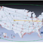
Timing is essential to our economic and national security. It is needed to synchronize networks, for digital broadcast, to efficiently use spectrum, for properly ordering a wide variety of transactions…
Galileo Second Generation proof-of-concept testing begins
The first Galileo Second Generation hardware has begun testing, with test versions of the satellites’ navigation payloads undergoing evaluation by Airbus Defence and Space at their Ottobrunn facility in Germany and by Thales Alenia Space at ESA’s ESTEC technical centre in the Netherlands.
These testbed versions of these new navigation payloads …
The USA has issued the Memorandum on Space Policy Directive 7 on January 15, 2021. This Space Policy Directive establishes implementation actions and guidance for United States space-based Positioning, Navigation, and Timing (PNT) programs and activities for United States national and homeland security, civil, commercial, and scientific purposes
This policy complements the guidance set forth in …
NASA advancing GNSS capabilities
NASA is developing capabilities that will allow missions at high altitudes to take advantage of signals from Global Navigation Satellite System (GNSS) constellations — like GPS commonly used in the U.S. These signals — used on Earth for navigation and critical timing applications — could provide NASA’s Artemis missions to the Moon …

The polar regions aside, access to highly accurate positioning, navigation and timing (PNT) data opens up enormous potential for economic growth, reduced inequality, and international co-operation. Access to Global Navigation Satellite System (GNSS) has become a fundamental expectation and mainstay of the modern world.
Discussion draft of the National Unmanned Aircraft System (UAS)
The Government of India has released the discussion draft of the National Unmanned Aircraft System (UAS) Traffic Management Policy framed by the UTM Committee constituted under the Ministry of Civil Aviation. This policy is drafted under the overarching framework of the Draft UAS Rules 2020 and …
GSA releases the 3rd GNSS user technology report
The European GNSS Agency (GSA) has just released its latest GNSS User Technology Report, providing a comprehensive analysis of latest GNSS trends and developments. With contributions from leading GNSS receiver and chipset manufacturers, the report serves as a valuable tool to support planning and decision-making with regards …


 (5.00 out of 5)