Articles in the Articles Category

The geoid can be determined using different method such as gravimetric, astro-geodetic, GPS/ Levelling and “satlevel”. ‘Satlevel’ is a new method of geoid determination, in which the ellipsoidal height is used with orthometric height to model the geoid. Geoid modelling is a process of developing mathematical algorithms to represent the geoid. This is the reference surface for orthometric height. Geoid is one of the geodetic surfaces.

Some of this publicity relates to the UK’s developments in the area of detecting GNSS interference, specifically the GAARDIAN program (for GNSS Availability, Accuracy, Reliability anD Integrity Assessment for Timing and Navigation). This was a wide collaboration between government, academia, and industry to develop a robust system for analyzing interference phenomena associated with GPS and eLoran systems and the effects on their use in safetyand mission-critical applications.
The United Nations Programme on Space Applications, the Offi ce for Outer Space Affairs held the United Nations International Meeting on Applications of Global Navigation Satellite Systems at the United Nations Offi ce at Vienna, Vienna International Centre, in Vienna from 12 to 16 December 2011. The Meeting was co-sponsored by the United States of America through International Committee on GNSS (ICG).
September 2012:
ION GNSS 2012, September 17-21(Tutorials and CGSIC: September 17-18),
NAshville Convention Center, Nashville, Tennessee, USA. www.ion.org;

Objective of accuracy investigation In this study, accuracy investigation of the corrected MMS measurement data by LMU and the mapping data derived from these corrected data were carried out to establish the most appropriate land mark point asignment (position intervaletc.) method at GPS invisible period. The target mapping scale is 1/500 and required accuracy is 25cm RMS for both horizontaland vertical.

Surveyors have a rich history and recognized longstanding contribution to societies worldwide. This will always be part of the surveyors’ identity and I don’t think using new technology will change that. I don’t think maintaining domain identity is exclusive of integration. There is a big difference between integrating technologies and integrating professions. Surveyors have many new tools producing large amounts of data, such as LiDAR, highprecision imagery, and GPS.

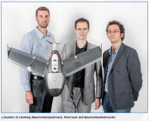
The idea for designing unmanned aerial systems (UAS) for rapid mapping originated from a doctoral dissertation in aerodynamics by Peter Cosyn, one of the three founders and now Director of R&D at Gatewing. Maarten Van Speybroeck, Director of Operations and Finance, was involved with this idea as subject for a thesis.
August 2012:
The XXII Congress of the ISPRS, 25 August – 1 September 2012,
Melbourne, Australia, www.isprs.org;


 (5.00 out of 5)