Articles in the Articles Category
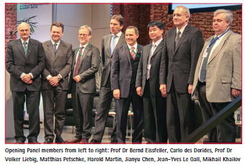
coordinates

Oct 2014 | One Comment

I have read the paper by Hannah (this volume), and I arrive at a totally the opposite conclusions, viz. that there is no indication what so ever of a recent sea level acceleration, and that it is the high rates around 3 mm/yr that should be “safely disregarded”.

Oct 2014 | Comments Off on Sea level change – An inconvenient fact or an irritating fiction?

In 2012, the United Nations Environment Programme issued its report on the most important emerging issues related to the global environment (UNEP, 2012). The top ranked issue in that report related to the alignment of land governance to the challenges of global sustainability.

Sep 2014 | No Comment

September 2014

GIScience 2014

23 – 26 September

Vienna, Austria

www.giscience.org

 
October 2014

INTERGEO 2014

7-9 October

Berlin, Germany

www.intergeo.de

6th Asia Oceania Regional Workshop on GNSS

9-11 October 
Phuket, Thailand

www.multignss.asia/workshop.html

GeoForm

14-16 October 2014 
Moscow, Russia

http://www.geoexpo.ru/en-GB

Esri Mid-East & Africa User Conference

22 – 24 October 2014 
Kuwait

http://www.esri.com/events/meauc

ISGNSS2014

22 – 24 October 
Jeju Island, Korea

www.isgnss2014.org

35th Asian Conference on Remote Sensing

27-31 October

Nay Pyi Taw, Myanmar

www.acrs2014.com

NZIS Conference 2014

29 Oct – 1 Nov 
New Plymouth, New Zealand

www.nzisconference.org.nz

November 2014

Trimble …

Sep 2014 | No Comment

Lost its way
Galileo 5 and 6, the pair of Galileo satellites,
Were launched on Aug 22, 2014.
Instead of the expected circular orbit.
They were released on a lower and elliptical orbit,
Although the ‘wayward’ satellites are said to be safely under control,
Studies are being conducted to determine
The scope of the anomaly
And its impact on the mission
Are yet to …

Sep 2014 | No Comment

In the 1990’s there was a great change in the Brazilian Geo-technology market, with the introduction of Total Stations, substituting the products that were available at the time. In the 2000´s, there was yet another transformation in the market with the introduction of the GPS L1/L2.

Sep 2014 | No Comment

NavCom off ers our products and services through a network of over 40 authorized resellers and OEM relationships in 25 countries. Our sales channel partners are the key to our sales success as well as a core element of our product improvement and development process. Our resellers know their respective markets and customer needs.

Sep 2014 | No Comment

Arecord of more than 16,000 Esri users attended the company’s weeklong annual Conference (Esri UC) and five concurrent events in San Diego, California, this past July.

Sep 2014 | No Comment

The new Bureau to lead the United Nations Committee of Experts on Global Geospatial Information Management (UN-GGIM) has been elected by the Member States.

Sep 2014 | No Comment

Emergent coastal structures such as groins, detached offshore breakwaters, and sea walls have been successfully adopted as coastal protection measures for many decades (Dean and Dalrymple, 2001: Silvester and Hsu, 1997). These type of structures are common in the US and Europe (Dean and Dalrymple, 2001), and even more so in Japan, where Seiji et al.

Sep 2014 | No Comment

European Geostationary Navigation Overlay Service (EGNOS), the European Satellite Based Augmentation System (SBAS), provides corrections and integrity information to GPS signals over a broad area centred over Europe, and is fully interoperable with other existing SBAS systems (e.g., WAAS, the brand name of the American SBAS).