
Articles in the Articles Category


In 2019 we saw massive worldwide disruption from GNSS jamming, spoofing and other vulnerabilities. The scale of the disruptions we observed was unprecedented and even though to some of us there had been many indicators that this sort of…

Hope and wish
Another economic slowdown?
Yes, if we go by the recent International Monetary Fund (IMF) alert,
Which downgrades the growth to 3 per cent for 2019.
This is said to be the worst in last decade.
This is happening primarily due to decline in manufacturing activity,
And also because of US-China trade conflicts,
Higher …
January 2020
International Workshop on Advanced Spatial Analytics and Deep Learning for Geospatial Applications
20 – 31 January
Bengaluru, India
www.workshop.csag.res.in
Precise Time and Time Interval Meeting (PTTI)
21 – 24 January
San Diego, USA
www.ion.org
March 2020
Munich Satellite Navigation Summit
16 – 18 March Munich, Germany
www.munich-satellitenavigation-summit.org
10th International Conference and Exhibition on Geospatial & Remote Sensing (IGRSM 2020)
17 -18 March
Kuala Lumpur, Malaysia
http://igrsm.org/igrsm2020
Geo Connect Asia 2020
18 …

This report presents ten case studies on LRS ASD approaches – 6 where PPP has been fully adopted; two outright rejections (one of which also considered full privatization); and two which have adopted alternative approaches…

Within the “Tarquinia Project” and the “Centro di Ricerca Coordinato”, involving different groups of the Università degli Studi di Milano (Archaeology, Computer Science and Communication, Geoarchaeology, Palaeoanthropology)…
November 2019
International Navigation Conference 2019
18 – 21 November Edinburgh, Scotland
https://rin.org.uk/events
GEOTEC HANOI 2019
November 28-29, 2019 Hanoi, Vietnam.
https://geotechn.vn
December 2020
Amsterdam Drone Week
4-6 December 2019
www.amsterdamdroneweek.com
International Committee on Global Navigation Satellite Systems (ICG)
8 – 13 December Bengaluru, India
www.icg14.org
International Workshop on ‘Capacity building and Education Outreach in Advanced Geospatial Technologies and Land Management’
10 – 11 December, 2019 Dhulikhel, Nepal
www.lmtc.gov.np/workshop
39th INCA International …
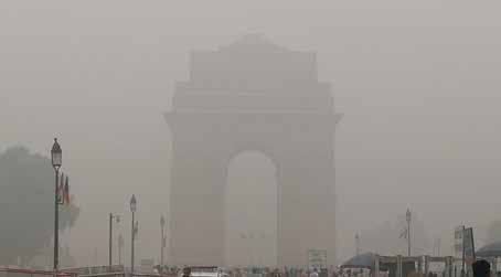
Gasp Chamber
With air quality at dangerous level
This time around air pollution in Delhi
Led to health emergency.
Several desperate measures were taken,
Banned on construction activities,
Plying of vehicles with odd-even numbers on odd and even dates
Schools closed for few days,
Alas! not with desired results.
The Supreme Court of India fumes,
Governments scramble for actions, politicians blame each other,
And the saga …

Professor Peter Teunissen
shares his views on a wide range of subjects related to GNSS
Professor Peter Teunissen has recently received Johannes Kepler Award from ION for his influential and groundbreaking contributions to the algorithmic foundations of satellite navigation and sustained dedication to the global education of next generation of navigation engineers (https://www.ion.org/ awards/2019- Kepler.cfm ). He …
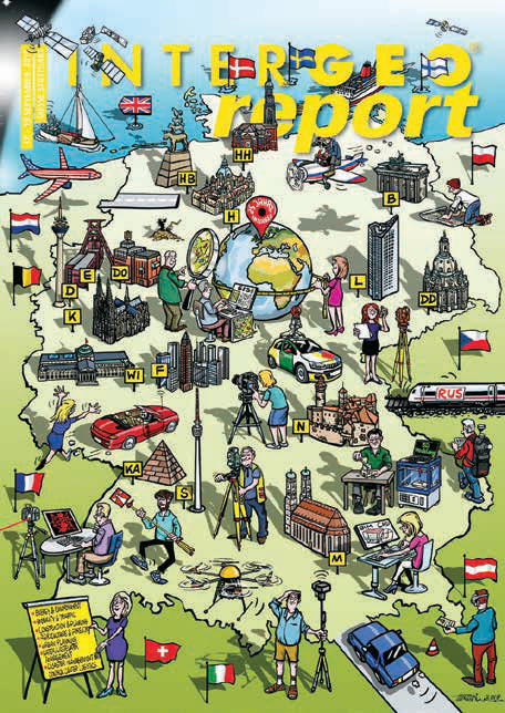
25th INTERGEO: 17 – 19 September 2019 Stuttgart, Germany
The leading international trade fair for geodesy, geoinformation and land management – together with the CONFERENCE and its themed platforms INTERAERIAL SOLUTIONS, SMART CITY SOLUTIONS, GEOCAREER and GEOINNOVATION CAMPUS – drew in 20,000 visitors from over 100 countries to the exhibition halls in Stuttgart. This year, 705 …

Any engagement in dialogue on proposed changes to land registry services delivery, either through privatization or Public Private Partnerships…


 (5.00 out of 5)