Articles in the Articles Category

Nature strikes at will.
Some areas and people are better prepared.
Some are not.
Haiti is a case in point.
Poor infrastructure.
Inadequately trained personnel.
Weak cooperation among institutions.
And the situation worsened
When the earthquake struck.
Tremendous efforts have been made.
And are being made.
Still.
Any lesson learnt?
Bal Krishna, Editor
bal@mycoordinates.org
Tweet

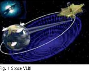
Space Very Long Baseline Interferometry (SVLBI) is an extension of the ground-based VLBI technology to space, which involves a simultaneous observation of the same radio source by two stations; one on the ground, the other being space-based. It could not only overcome the baseline length limitation problem specific to groundbased VLBI technology, with a great improvement on the observation resolution, but could also directly…

The Netherlands are a small country in the North West part of Europe with a high density of population. The area of only 41.000 km² is used by 16 Mio. Inhabitants, resulting into 400 inhabitants per km². There is an excellent infrastructure with 2.300 km of motorways and 137.000 km of roads in total complemented by a network of railways and bicycle tracks. The roads are used by 8 Mio. cars and 140.000 heavy goods vehicles. Although…

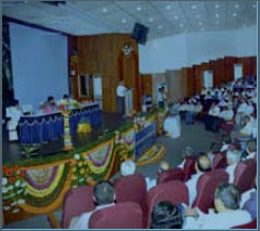
The NRSC User Interaction Workshop 2010 organised by the National remote Sensing Centre (NRSC), Department of Space, India was an opportunity to inform the Geo spatial user community regarding the various developments that have happened in terms of Products and services available to them and also for the user community to share their experiences.
G. Balachandran, …

With the wide access to relatively inexpensive or freeware computer software for map production and using the Internet and the World Wide Web (Web) for dissemination this process has been automated somewhat, enabling the production of products and (Web) publishing to be fairly straight-forward. Using the Web as a publishing medium has allowed these relatively small voices to disseminate their viewpoint, which might otherwise be impossible…

The Munich Satellite Navigation Summit 2010 was held from March 9 – 11 in the famous Residenz Munich, traditionally organized by the Institute of Geodesy and Navigation of the University FAF Munich. Prof. Bernd Eissfeller, Director of the hosting Institute, was delighted to welcome 450 attendees from about 25 nations.
GNSS – quo vadis?
This year´s motto …
April 2010
Geo-siberia 2010
27 – 29 April
Novosibirsk, Russia
www.geosiberia.sibfair.ru
ASPRS 2010
26-30 April
San Diego, CA, USA
http:/www.asprs.org/Sandiego2010
May 2010
INTERGEO East
19-21 May 2010
Istanbul, Turkey
www.intergeo-east.com
TIDES 2010
20 – 21 May
Taipei, Taiwan, R.O.C.
derc@mail.pccu.edu.tw
International Conference on Integrated Navigation Systems
31 May – 02 June 2010
Saint Petersburg, Russia
http:/www.elektropribor.spb.ru
June 2010
Toulouse Space Show 2010
8 -11 June
Toulouse, France
Contact@toulousespaceshow.eu
www.toulousespaceshow.eu
IMTA Asia Pacific Conf. & Trade Show
18 -19 June
Melbourne, Australia
www.maptrade.org/events
GEA’2010
22 -24th June
Cracow, Poland
jacek@gea.com.pl
http://gea.com.pl/targieng.php
July 2010
ISPRS …

Do you know…
That I know…
The process.
To determine positions.
Accurate positions.
Of ‘what’ and ‘where’.
On and around this Earth.
I prepare the foundation.
The basics of ‘knowledge’.
On which much can be built.
I play a role.
A very important role.
Who am I?
I know that you know.
Still, I reiterate.
That I am a surveyor.
Bal Krishna, Editor
bal@mycoordinates.org
Tweet

Over the past 100 years the world’s total population has quadrupled – from 1.6 billion to 6.6 billion. (Footnote: Population Bulletin, “World Population Highlights: Key Findings From PRB’s 2007 World Population Data Sheet” http:// www.prb.org/Articles/2007/623WorldPop. aspx.) In many parts of the world we see growing poverty. We now face increasingly worrisome resource constraints and environmental difficulties,

A GAGAN (GPS Aided Geo Augmented Navigation) is an Indian SBAS (Satellite Based Augmentation System) intended to provide accurate and reliable navigation information for all phases of flight over the Indian FIR (Flight Information Region) and in the adjoining areas applicable for safety-of-life operations meeting the performance requirements of ICAO. The implementation of the GAGAN program is being realized through the following two phases…


 (5.00 out of 5)