Articles in the Mapping Category

The number of people living in informal settlements around the world is difficult to measure precisely, but some estimates put it at close to one billion, or almost one…

In the geospatial domains we can witness, that more spatial data than ever is produced currently. Numerous sensors of all kinds are available, measuring values, storing them in databases…

The Statement 1 of the FIG Brochure ‘Cadastre 2014’ stipulates Cadastre 2014 will show the complete legal situation of land including public rights and restrictions.

The study area is located near the Koru (Lapseki/Çanakkale) village in northeastern part of the Biga Peninsula. Koru deposit is hosted by volcanic rocks which are directly related to economically significant mineralization such as Pb-Zn. This deposit is shaped by Tertiary volcanic units, including rhyolitic lava and tuffs.

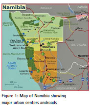
This study investigates the potential of using Unmanned Aerial Vehicles (UAV) in surveying and mapping customary land parcel boundaries. In Namibia, new laws demand for the boundaries of individual and collective customary lands to be adjudicated, mapped and recorded…

China’s land registration has a very long history. According to archaeological discoveries, at least in Western Zhou Dynasty (9th century BC

3D cadastre models are recognized as valuable solutions to provide enriched spatial representation for overlapping properties, above-ground and subsurface infrastructures, mining rights, etc. (Paulsson and Paasch, 2013;Pouliot et al., 2011; Stoter et al., 2013).

The rapid development and increased demand for spatial information infrastructures in many jurisdictions have made spatial information an invaluable tool in policy formulation and evidence-based decision making.

During the last ten years, the possibilities for data acquisition in geodesy have been rapidly improved. The devices have become cheaper, smaller and more accurate and, on the other hand, they are capable of gathering a large number of data within a very short time interval.

UAV (Unmanned Aerial Vehicle) is the latest photogrammetric system which has been used across many fields such as a military reconnaissance, heritage site documentation, a precise agriculture mapping, a construction site mapping, a real-time hazard mapping project, etc…


 (5.00 out of 5)