Articles in the His Coordinates Category

Sep 2012 | No Comment

Considering the transformational rate of growth in passenger traffic, airline fleet and the aircraft movements anticipated in the next few decades, the challenges that confront aviation are the need for matching airport/CNS-ATM infrastructure, airport/airspace capacity enhancement and technology up gradation.
Sep 2012 | No Comment

The primary objective of ISAC is to build satellites to meet national requirement of the country in various application areas like satellite-based communication, navigation, national natural resources management, oceanography, meteorology, cartography and exploration of outer space and other planets, etc.

Jul 2012 | No Comment

Surveyors have a rich history and recognized longstanding contribution to societies worldwide. This will always be part of the surveyors’ identity and I don’t think using new technology will change that. I don’t think maintaining domain identity is exclusive of integration. There is a big difference between integrating technologies and integrating professions. Surveyors have many new tools producing large amounts of data, such as LiDAR, highprecision imagery, and GPS.
Jul 2012 | No Comment

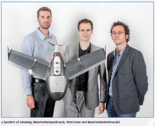
The idea for designing unmanned aerial systems (UAS) for rapid mapping originated from a doctoral dissertation in aerodynamics by Peter Cosyn, one of the three founders and now Director of R&D at Gatewing. Maarten Van Speybroeck, Director of Operations and Finance, was involved with this idea as subject for a thesis.

Mar 2012 | No Comment

IFEN was the first company in Europe to work on ground based integrity monitoring. Starting out with research and development in 1999 for regional augmentation system EGNOS V1, IFEN is currently providing maintenance to the current SoL certified EGNOS V2 for the integrity check. Furthermore, IFEN will continue to make major contributions to the ongoing definition of the next generation EGNOS V3.

Feb 2012 | No Comment

While for foreign users, services are providing IRS satellite data, establishment and upgradation of ground stations for IRS data reception and RS data contributions from Indian Space Research Organization (ISRO) for disaster agreements such as International Charter and Sentinel Asia.

Feb 2012 | No Comment

As you are aware GPS meets most of the navigation requirements of users. However, to improve the performance and integrity of the GPS system and to meet civil aviation requirements, the basic GPS system is to be augmented by GEO satellite with corrections and confi dences.

Feb 2012 | No Comment

The Spectra Precision business within Trimble had very rapidly assembled a portfolio of optical and GNSS surveying products. While Spectra Precision had in-house engineering, design and manufacturing capabilities on the optical side, the GNSS products had been sourced from a variety of external suppliers.

Jan 2012 | No Comment

Indeed, the successful launch of two Galileo satellites on 21 October 2011 from French Guyana was a key step for the programme. Galileo is now becoming a reality and I am really proud of it. The EU, with its partners, in particular the European Space Agency, has demonstrated its ability to manage such a large scale programme. We are reaping the fruits of our continuous efforts. The programme is under control both on programmatic and fi nancial levels and it is now possible to accelerate the deployment of the constellation of satellites. That is why I have decided to buy additional satellites.

Dec 2011 | No Comment

The most important achievement of the National Spatial Data Infrastructure (NSDI) has been bringing together many agencies to work for a cause. It had not been easy and it took more than ten years to reach at this stage. In addition, we were involved in the standards development activities of NSDI for Metadata (2005/2009) and National Spatial Data Exchange Standards (NSDE- 2003). NSDI is seen as Standards organization and Bureau of Indian Standards (BIS) is in the process of constituting a mirror committee for ISO TC 211 with NSDI as anchor.