Hyundai Robotics and Hyundai E&C to develop construction robots
Hyundai Robotics, Korea’s No. 1 industrial robot producer, has joined hands with Hyundai E&C to develop construction robots. Through this MoU, both companies will jointly carry out
• The development of robots working at construction sites
• Mobile service robot business
• Development of core technologies …
VSR700 prototype performs first autonomous free flight
The prototype of Airbus Helicopters’ VSR700 unmanned aerial system (UAS) has performed its first free flight. It performed a ten-minute flight at a drone test centre near Aix-en-Provence in the south of France. It derived from Hélicoptères Guimbal’s Cabri G2, is an unmanned aerial system in the 500-1000 kg …
ESA’s COVID-19 space hunting platform
The European Space Agency (ESA) has recently launched an internal initiative to cull ideas for supporting its member states in the study and analysis of the COVID-19 pandemic. Under this initiative ESAC’s Galileo Navigation Science Office has managed to get one of its ideas taken up under the name of …

SpaceX launches third GPS Block III satellite
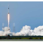
SpaceX launched their Falcon 9 rocket with the third Block III GPS satellite, named SV03. Block III is the next generation of GPS satellites, replacing the aging Block II series. This will be SpaceX’s second GPS launch, out of the five they have been awarded so far.
SpaceX previously launched …
Bentley Systems’ The Cohesive Companies
Bentley Systems, Incorporated has announced that its Acceleration Fund has launched The Cohesive Companies, a wholly owned subsidiary, anchored by the acquisition of Atlanta-based Cohesive Solutions. The new business venture will include the services team from Bentley’s AssetWise business and the offerings of Bentley, Cohesive, and IBM’s Maximo to support the …

As coronavirus disease 2019 (COVID-19) struck Florida, Sarasota began locking down its municipal buildings, and the daily workload of many city employees waned
Sarah Alban
Director of Marketing at Eos Positioning Systems.
A parking enforcement officer and city clerk are part of an innovative project in Sarasota, Florida. Municipal staff whose traditional daily work has decreased due to …

The safety of engineering structures requires periodic inspection. Assessing the condition of the structure and its behavior cannot be done without a regular and frequent monitoring by establishing a network of geometric auscultation. The contribution of an analytical tool in the management of this network is the purpose of this work…

This paper is intended to establish living structure – a physical phenomenon and mathematical concept – as a formal concept or foundation for maps and mapping
Bin Jiang
Professor, Faculty of Engineering and Sustainable Development, Division of GIScience, University of Gävle, Sweden
Terry Slocum
Professor, Department of Geography and Atmospheric Science, University of Kansas, Lawrence, USA
Abstract
The Earth’s surface or …

The impact of COVID-19 is most dramatic in the slow down of workforce training, education, and research at universities
Chris Rizos
Emeritus Professor in the School of Civil and Environmental Engineering and a co-director of the Satellite Navigation and Positioning (SNAP) Lab at UNSW. Chris is presidentelect of the International Union of Geodesy & Geophysics (IUGG)
At first …

Volume XVI, Issue 7, July 2020
Transforming the old map series to the modern geodetic reference system
Georgios Moschopoulos, Nikolaos Demirtzoglou, Antonios Mouratidis, Dionysia-Georgia Perperidou and Dimitrios Ampatzidis
Clipper Adventurer Grounding
Bruce Calderbank
Covid-19 and the Surveying Profession: A New Zealand Perspective
John Hannah
AUSPOS and CORSnet-NSW: A match made in heaven
Volker Janssen and Simon McElroy
My Coordinates
EDITORIAL
News
INDUSTRY | GNSS | GIS | …


 (5.00 out of 5)