An attempt is being made by volunteers all over the world to visit the confl uence points and document the scenery with pictures and narratives
Europe and Russia to restart talks on Galileo and Glonass operations
Negotiations on interoperability between the European Galileo and Russian Glonass satellite navigation systems are expected to restart soon, after a yearlong hiatus. The hope of talks follows an agreement on dialogue structures between the European Commission and Russia’s Federal Space Agency (FSA).
A trilateral steering board has been created for discussions between the EC, European Space Agency and the FSA. ESA already has working groups covering areas of co-operation under its framework agreement with the FSA, including satellite communications, global navigation and technology. These will include EC representatives and will report to the new steering board. A new working group on Earth observation will also be created.
www.flightglobal.com
Delhi faces confusion and chaos.
With a pressure to host Commonwealth games in 2010.
Unauthorized construction, encroachments, illegal …

Forest cover in Philippines on the rise
The Department of Environment and Natural Resources (DENR) revealed recently that satellite imagery and remote sensors indicate that the forest cover in Central Luzon has increased to 7.2 million hectares from 6.5 million hectares in 1988. www.manilastandardtoday.com

Transformation of GPS derived ellipsoidal height to orthometric height is one of the most important applications of gravimetric geoid. Its applicability remains questionable if the above transformation cannot be done to a reasonable order of accuracy. Use of GPS observations at levelling benchmarks and subsequently determined geoidal seperation using the geometrical relationship between geoid and ellipsoid (see fig. 1 )…

Border inspection mapping operation
China and Nepal will jointly launch a border inspection mapping operation. Both countries will apply GPS to survey the border marks. The major mapping work will be done by Chinese workers and then workers from Nepal will check the mapping data and results. The Surveying and Mapping Bureau of Shaanxi, from northwest China, has been appointed to take the task and will form the main body of the China team. The first batch of mapping workers are scheduled to arrive in the China-Nepal border area next month and all the outdoor surveying is planned to finish by the end of September. It is expected that the final mapping outcome will be unveiled by the end of 2007. www.vnagency.com.vn

Was there any pre-signal of Pakistan earthquake? SHUNJI MURAI AND HARUMI ARAKI
Optimizing gravimetric geoid solution
SK SINGH, BRIG B NAGARAJAN, PK GARG
Water vapour estimation at few GPS sites in Indian subcontinent SRIDEVI JADE AND MSM VIJAYAN
Design methods for RF part of GNSS software receivers PAVEL KOVAR, PAVEL PURICER, JOSEF SPACEK
Advent of modern cartography in nautical charting RB SINGH

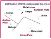
The authors have continued a research on the prediction of earthquake using GPS data in Japan, one of the disaster prone countries since 2000. The authors have discovered pre-signals of those past big earthquakes with more than M6, such as Miyagi Offshore and Hokubu Earthquakes (2003.5.26; M7.1 and 7.26; M6.4), Tokachi Offshore Earthquake (2003.9.26; M8.0)…

GLONASS for civilian use in 2006
The restrictions on precise satellite definition of on-land coordinates will be lifted by yearend, a senior military official said. Lieutenant-General Valery Filatov said the location of geographical objects at accuracy of up to 30 meters would be available for civilian use from the Russian GLONASS satellite system and the US GPS.
www.spacedaily.com

Chunghwa Telecom and SiRF to offer A-GPS services
Chunghwa Telecom in Taiwan announced the formation of an alliance with SiRF International to establish an A-GPS platform for operation of mobile location services in the Taiwan market. CHT has finished R&D and testing of the A-GPS platform that integrates GPS technology with CHT’s mobile communication infrastructure, It initially offered A-GPS services to Taiwan SECOM, one of the largest provider of security services in Taiwan, at the end of last year and plans to offer personal A-GPS value-added services to mobile communication users later this year.
www.digitimes.com

New Tiny Surface Mount GPS Receiver
Trimble has introduced its new Copernicus GPS receiver – a thumbnail-sized, surface-mount, low power module ideal for adding GPS capabilities to Bluetooth appliances, sport accessories, personal navigators or cameras, computer and communication peripherals as well as vehicle tracking, navigation, and security products.
It enables system integrators to easily add GPS capability to a mobile device with minimal impact on its size or battery life at a very economical price.
www.trimble.com


 (5.00 out of 5)