| His Coordinates, Interviews | |
“A web-based transport system is well developed in Hong Kong”
|
||||
Tell us about your departmentThe Department of Land Surveying and Geo-informatics is the only academic unit in Hong Kong that provides a broad education in Geomatics. In addition to fulltime degree and Higher Diploma programmes, the Department offer part-time degree and postgraduate programmes for technicians and professionals to upgrade their academic qualifications. The Department also provides research programmes leading to MPhil and PhD awards. All of our programmes are carefully designed to meet the needs of the local professional community and to meet international standards. What are the objectives of research activities?Research activities are mainly conducted under the Research Centre for Geo-Information Science and Technology with the following aims: • To conduct specialised research in geo-information science and technology; • To promote external research collaborations; and • To promote applications of latest research outputs and to provide services to the local and international communities. There are three main research laboratories under the umbella of this Centre: • Laboratory for Environmental Change (LEC) which is concerned with monitoring of environmental changes and natural hazards • Laboratory for Integrated Navigation Technologies (LINT), focusing on integrated navigation technologies and information systems • Cyber City Laboratory (CCL), which conducts research on technologies for the development of cyber city What research is being done in natural hazards?Some of our research activities focus on detection and interpretation of landslides using satellite sensor image. Landslide monitoring which requires large areas to be surveyed at a detailed level has previously been unsatisfactory due to its reliance on air photo interpretation. One of our studies demonstrates the synergistic use of medium resolution, multitemporal SPOT XS, and fine resolution IKONOS images for landslide inventories using change detection and image fusion. The visual quality of images obtained from Pansharpening of IKONOS images is comparable to that obtainable from 1:10,000 scale air photos. Another study in our department demonstrates that old landslide trails over 50 years old can be interpreted using a DEM from IKONOS stereo images. We have also used GPS to monitor crustal deformation. In north China, the velocity field obtained by GPS surveying during 1995 to 2001 is used for calculation of crustal deformation rates. The number of total GPS stations is about 450 in this area. Do you conduct research in the field of engineering?Research is being conducted to develop specialized technologies to apply GPS to monitoring the health conditions of structures such as bridges, tall buildings, slopes and dams. We have developed a patented multi-antenna GPS technology that allows one GPS receiver to be used to monitor the motion of a series of points to substantially reduce the cost of GPS hardware. We have also been developing special data processing algorithms to enhance the accuracy and reliability of GPS. And what about meteorological research?Recently, a technique of remote sensing water vapour in the atmosphere using GPS has been rapidly developed. The estimation accuracy of 1-2 kg/m2 has been routinely available from ground based GPS networks. Extending this technique into the sea on a moving platform would be greatly beneficial for the meteorological research, such as calibration of satellite data and investigation of sea/air interface. A new method based on Kalman filter technique has been developed to estimate water vapour under a kinematic environment. In addition, we have also concentrated on the study of ionospheric disturbances in Hong Kong and their effects on GPS. Also, a new method is proposed to establish a precise local ionospheric delay model based GPS reference network. What issues in navigation are faced by Hong Kong?Locating a car on a road map is an important function of a car navigation system. GPS is widely used for vehicle navigation due to its high accuracy and low cost but in an urban environment, GPS satellite signals are blocked by buildings and other obstructions. In urban Hong Kong, GPS availability is less than 30%. A navigation system that integrates GPS, Dead Reckoning (DR), radio beacons, and digital map and navigation databases, has been developed. It includes several new techniques developed by the research team in the department, including adaptive Kalman filter for sensor integration, tight integration of map and positioning sensors, and Bluetooth-based radio beacon. With the integrated system, positioning availability increases to over 96%. Another research related to map matching for vehicle navigation is supported by a number of projects from government, industry, research council, and the university. A new map-matching method is developed that can be implemented in different platforms. It consists of a number of basic functions, such as road identification, road following, road feature extraction, and reliability assessment. The precise map information has also been integrated with the navigation units to provide calibration for DR errors. Do you think we need more user-friendly maps?Yes, the main requirement of maps for navigation purpose is effectiveness. Experimental results in psychology indicate that it is dangerous for the driver to leave his/her attention away from the road for more than a few seconds. To make maps effective, general-purpose maps should be greatly simplified because too much information on the map would confuse the driver. Furthermore, map symbols critical for navigation should be more attractive than symbols for the surrounding environment. The aim is to achieve optimum design of effective maps for land vehicle navigation. In one of our studies, effective use of visual variables (shape, size, orientation and color), dynamic variables (duration, change of rate and order), and exploration acts (blink, highlight, zooming, pan, drag and click) in dynamic visualization are explored, and maps with different complexity and perspective points are designed and experimentally tested in Hong Kong. What is the status of public transport system?Hong Kong’s public transport system is complicated. Residents and tourists rely on public transport for everyday travel. To assist people, a web-based multi-modal public transport query and guiding system, EASYGO, has been developed. This is a collaborative venture between the Department of Land Surveying and Geo-Informatics of the Hong Kong Polytechnic University and the Brilliant Technology Development Limited. The system finds optimal travelling routes for users in terms of fewer mode transfers, shortest travelling time and lowest fare. It is designed for mobile phone and internet connection so that transport users may plan their travels in advance. EASYGO is multi-modal, in that it includes all legally run public transport modes throughout the whole territory of Hong Kong and those linking to the neighbouring Guangdong townships and cities. These cover all kinds of mass transits, buses, minibuses, ferries and trams. The project started in early 2002 and is now commercialized with the collaboration of several telecom companies. The system has also widely been used among visitors, students and staff via the University campus kiosks and portal system. What about LBS in Hong Kong?Although mobile positioning technology has many potential applications in Hong Kong, the use of LBS is still at an early stage. Major concerns are related to its accuracy and reliability. It is believed that LBS platforms now available in Hong Kong can generally provide positional information better than 500m accuracy in the urban area which would be sufficient for various applications such as manpower and fleet management, transportation query and guidance system. This research investigates the accuracy achievement of current LBS in Hong Kong. It was found that the current LBS can generally provide better than 200m accuracy in urban areas, but the positioning error in rural areas can be as high as 1km. The trend for LBS in Hong Kong will gradually move to the hybrid positioning technique, which is the combination of AGPS and cellular network positioning, to provide high accuracy indoor and outdoor location based services. Future application of LBS technology are only limited by our imagination, and include manpower and fleet management, travel aids, location identification in case of emergency, and the provision of guidance for visually impaired persons. Any interesting application of geospatial technology?Terrestrial laser scanners provide high density, accurate spatial data, but do not (typically) provide high quality spectral information and are earth-bound. Cameras produce high quality spectral information and can be moved freely about an object, but photogrammetrically extracting 3D data can be cumbersome and time consuming. Methodologies to exploit the positive characteristics of these two technologies to automatically produce representations that contain high quality spatial and spectral information have been developed.
|
||||
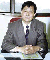 Dr. Chen Yong-qi has been a Chair Professor and Head of Department at the Hong Kong Polytechnic University since 1994. Before joining the university he was Professor and Head of Department in then Wuhan Technical University of Surveying


 (No Ratings Yet)


