
New Magellan ProMark™3 RTK alters the RTK Landscape
Magellan has announced the introduction of its ProMark3 RTK, designed to provide surveyors with centimeter accuracy in a realtime solution and complete postprocessing and mapping capabilities. It operates in two modes; base + rover and rover only. The rover can be connected to a real-time network through a GPRSenabled cell phone using NTRIP and direct IP. The base + rover, employs plug-and-play spread-spectrum radio solution that does not require a license or separate con? guration integrated with ProMark3 RTK. cgeffroy@magellangps.com

Sustainability is the key issue in forest management, be it India, or any other part of the globe. Unfortunately, so far, no scientifi cally sound and operational defi nition of Sustainability has been evolved for universal application in forest management. Nevertheless, it may be said on an empirical basis that sustainable forest management lies in attaining three basic goals: fi rst, maintaining the stability of the physical environment, secondly, maintaining, and if necessary increasing, the biological productivity of the resource, and thirdly, establishing equity in distribution of qualitative and quantitative benefi ts generated by the resource in the society dependent on it. The goals are to be attained not at any chosen point of time, but in perpetuity. Sustainable forest management is a multidimensional process. The major dimensions of the process are: ecological, silvicultural, technical (including the disciplines of genetics and biotechnology), socio-economic, and institutional. All the dimensions are equally important and neglect of any can mar the Sustainability of the process.
There is news.
That too a good one.
Reportedly, all 4,800 maps of the Survey of India will be available in public domain.
As many as 2,900 are of open series.
It would happen by March end.
The commitment(!) comes from the Minister himself. The Minister of Science and Technology, Government of India.
It looks like actualization …
Galileo – the European Programme for Global Navigation Services for civil purposes is an initiative led by European Union. We provide regular updates to our readers on the Galileo programme.
Abu Dhabi to introduce new road maintenance system
Abu Dhabi is preparing a unique Road and Bridge Asset Management System. The system would establish a satellite-aided geographical database by using the GPS. It will also feature an e-archives for road executive designs and an e-connection with other working systems. The system seeks to standardize the methods and costs of maintenance work of the 20, 000- km road network and 90 bridges in the emirates, according to an official at department for Municipalities and Agriculture. www.khaleejtimes.com
Geospatial Intelligence Standards: Enabling a Common Vision
The National Geospatial-Intelligence Agency (NGA) has issued a new document that provides guidance and direction to develop an overall baseline for common geospatial standards used to share, manipulate, and exploit digital geospatial data. The document, “Geospatial Intelligence Standards: Enabling a Common Vision,” outlines the standards that will be used in the National System for Geospatial-Intelligence (NSG). The NSG is the combination of technology, policies, capabilities, doctrine, activities, people, data and communities necessary to produce geospatial intelligence (GEOINT) in an integrated multi-intelligence, multidomain environment. www.nga.mil
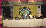
Second ESRI Asia-Pacific User Conference, 18-19 January, 2007, New Delhi, India
The Second ESRI Asia-Pacific User Conference under the theme of “GIS for economic development” was held at Hotel Taj Palace, New Delhi, India on January 18-19. Organized by ESRI India, the event witnessed participation from more than 900 …

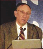
Navigare Necesse Est is the Latin tag that underpins the basic necessity of all forms of life to fi nd their way to survive and prosper. Today’s new world of ubiquitous electronic navigation supremely illustrates that dictum. Says Dick Smith, newly elected President of the International Association of Institutes of Navigation (IAIN)
Would you …
Jack Dangermond shares his observations with Coordinates
Challenges that Coordinates should focus on
A big challenge is integrating the surveying profession with the GIS profession. There’s a growing tension between them. One of the bridges that I want to accomplish this year is integrating the technology so the surveyors can have tools within …
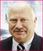
Prof Dr Güenter W Hein, Director of the Institute of Geodesy and Navigation, University FAF, Munich, on GNSS trends, applications and challenges
Please tell us about the focus of research at your Institute.
The Institute of Geodesy and Navigation of the University FAF Munich with presently more than 30 research associates from various …


 (5.00 out of 5)