Generally, the entire railway line is divided into several sections, and each section is fi nished separately.
Firstly, we need to collect the existing information of one section, such as map and control points. Then, survey the topography of the working area, select position of control points, set the control point network, and produce the control points by GPS static survey…

There are generally 2 types of users of DGPS for professional survey one is the National Mapping Agency and other large govt. organization who undertake Survey projects and the 2nd category is comprising of private survey set ups most of whom are first time users of DGPS and use DGPS to cut down on the time and efforts Involved in surveying with ETS (electronic total station) along with spirit levels…

GPS has revolutionised positioning, navigation and timing (PNT) over the last twenty-fi ve years. During this period, we have come to rely on GPS to an unprecedented extent and GPS has gone from being an interesting research and development topic, to a professional niche market maker, to becoming the fourth utility and now to today’s mass market phenomenon…
Bentley has introduced the ‘Be Employable’ initiative. Can you explain what it is designed to accomplish?
Malcolm Walter: Worldwide, the infrastructure community is facing the relentless pressures of a diffi cult economy, and the downsizing of design and engineering organizations has become widespread. Bentley’s mission of ‘sustaining infrastructure’ encompasses the need to ‘sustain the professions’ that design, build, and operate our infrastructure, and the Be Employable program is dedicated to doing just that.

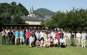
Th e ESA International Summer School on GNSS 2009 was held from July 20th to 30th in Berchtesgaden, Bavaria – Germany. Aft er the great successes in 2007 and 2008 the European Space Agency adopted the International Summer School on GNSS which itents to educate Satellite Navigation in an intersdisciplinary way and give a comprehensive overview on the design and development of satellite navigation systems and its applications. Bernd Eissfeller, leading organizer and director of the Institute of Geodesy and Navigation of the University FAF, Munich was plesed about this change. “Not only ESA is now part of this international activity concerning GNSS education”, he pointed out, “but also many high ranking universities which supported the Summer School for the fi rst time.” Th e 2009 organizing committ ee consisted of Eissfeller`s institute, the Stanford University (USA), the Institute Supérieur de l`Aéronautique et de l`Èspace (France), Aalborg University (Denmark) and Graz University of Technology (Austria). 47 participants from all over the world joined Summer School 2009, i.e. Russia, China, Australia, etc.

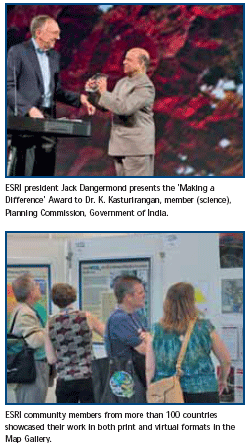
“Thank you for attending this year,” said President Jack Dangermond, ESRI, as he welcomed attendees at the 2009 ESRI International User Conference (ESRI UC). “Many things have taken place over the last year, and I’m particularly grateful you are here with us today. I know some of you came on your own money and traveled halfway around the world–I can’t say how much I appreciate that.”
What is wrong with quoting Columbus’ strange views on the shape of the earth on the opening page of a chapter entitled, “The World is a Pear”?
Those lines are from Columbus’ “Letter on his Third Voyage.” Even Davis isn’t using that as a description of the size and shape of the earth, just a cute vision from the often mistaken Columbus.


 (5.00 out of 5)