Creative Force Maps announced the first royalty-free, vector map of Washington DC to include building footprints, property lines, and land use. The digital map contains all building footprints and service alleys for 11 square miles in the heart of DC and, for maximum versatility, is available in Adobe Illustrator and PDF formats.
www.creativeforce.com
Tweet
The State Bureau of Surveying and Mapping (SBSM) will continue to promote 100 merit-based digital cities nationwide, which will rapidly push the construction and completion of the digital China geo-spatial framework. The digital city construction has made significant progress since its launch in 2006 and currently, 78 cities have been involved in the construction and …
From the vaults of the Asiatic Society of Mumbai founded in 1804, maps circa 18th Century – priceless, irreplaceable, hand-drawn and colourful original prints – have been disappearing.
Almost nothing remains of the entire set of maps that date back to 1803-04: they depict the expanse of Mumbai (then Bombay) in great detail when the first …
Minister Mah Bow Tan said Singapore’s land use planning for the next 10-15 years has to take into account new trends and emerging issues. Many of these issues are complex and may involve trade-offs between different objectives. He also launched a public consultation to seek public views on shaping Singapore’s physical landscape. The Urban Redevelopment …

|
||
|
||
|
||
|

Leica Geosystems’ digitizer for LIDAR Leica Geosystems announced the introduction of a full-waveform digitizer, WDM65, designed specifically for use with its ALS-series airborne LIDAR Systems. www.leica-geosystems.com GPSDifferential™ module for MobileMapper™ The GPSDifferential module for the MobileMapper 6 from Magellan is a software option that has been integrated into the new version of DigiTerra Explorer 6 to provide sub-meter performance for DigiTerra Explorer users working with a…

GPS ranging is based on the reception of the LoS component of the signals transmitted from the constellation of GPS satellite vehicles (SV), and on measuring the time elapsed in the propagation of appropriately time-marked signal signatures. Even in the absence of any reflected (multipath) signal components, the determination of physical separations between SVs and receiver is tied to a subtlety arising…

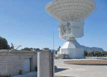
For interplanetary missions, the determination of S/C state vector (position and velocity) is required both for navigation purposes and science operations. The main error sources affecting S/C tracking data are the solar corona and the interplanetary plasma, which could be removed by using the multifrequency link technique between the probe and the ground station [1]. Once solar plasma noise has been removed…

Addition to LiDAR technology The European Space Agency (ESA) and Midaz Lasers Ltd. will work together on a development program to use alexandrite lasers to replace Nd:YAG lasers as the dominant source for LiDAR applications. LiDAR is currently dominated by YAG lasers as the laser source of choice but they can suffer from low efficiency and applications are restricted by lack of wavelength tunability which severely…

New Leica mojoMINI 3D Growers looking for an entry point into precision guidance now have the Leica mojoMINI 3D lightbar guidance system, which also comes with standard street navigation for daily use in any on-road vehicle. It comes with the Leica SmartAg antenna and GLIDE technology for in-field accuracy. www.mojoRTK.com Telmap Navigator for Android Telmap has released a special edition of Telmap Navigator for Android which…


 (5.00 out of 5)